By Johna Till Johnson
Photos by Vladimir Brezina
 Shinnecock Inlet to Montauk Point
36 nautical miles (41 land miles)
(click on photos to expand them—they look a lot better when they’re BIGGER!)
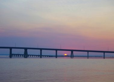
I was determined to see sunrise at least once during this trip, and today was the day! We were both up at 5 AM…


 .
.
… and soon after that the sun appeared on the eastern horizon, a glowing red ball in a haze of pink clouds.


But once the sun was up, there was no more time to admire it. This was the big day. Today we were going to paddle more than 35 miles up the open coast, without landing, and round Montauk Point.
.
There were several challenges involved. First, we had to pass out into the open Atlantic through Shinnecock Inlet. Inlets are narrow passages through the barrier islands that fill and empty the entire bays behind them as the tide rises and falls—and because they’re narrow, they feature very strong currents. Which means they can get rough, especially when a strong outgoing ebb current collides with large incoming ocean swells. In a narrow channel, the result can be huge breaking waves—risky for paddlers.
The best approach is to time things properly. Ideally, you want to pass through just around the time of the slack before ebb, before the ebb current gets dangerously strong. This morning, the slack before ebb in Shinnecock Inlet was predicted to be around 7 AM.
After that, the next challenge would be the paddle up the coast. On a calm day, there’s nothing particularly risky about paddling offshore through ocean swells. Landing on the beach through the surf, however, can be trickier. And for us—not entirely expert paddlers with heavily loaded boats—landing did pose a significant risk: one mistake and we risked a boat-breaking end to our trip. So we weren’t planning to land along this stretch of coast, except in an emergency. And 35 miles—10 hours or more—was going to be a long paddle without a break.
Oh, and if there were going to be any sharks… this was where they’d be. (As it turned out, we were attacked—but not in a way we anticipated!)
Finally, we were going to round Montauk Point. A strong tidal current flows round the point, and, when it collides with the ocean swells, can create what kayakers like to call “conditions”. Conditions are fun to play in—and good for practice—but at the end of a 35-mile trip they can strain your abilities. Ideally, we wanted a flood current at Montauk to smooth the swells and carry us round the point. And the flood current would cease around 9 PM—we had until then to reach Montauk.
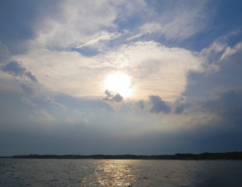
So today we would face not one, but three major challenges. And we were ready for them—or at least, as ready as we’d ever be. We’d listened to the radio, and the prediction was for three-to-five-foot swells—and so even larger surf—with perhaps a chance of a thunderstorm in the afternoon. The swells sounded fine. The thunderstorm? Not so much. But there was nothing we could do about it—besides, there’s always a chance of a thunderstorm in the summer!
So, after a hearty breakfast (salmon, oatmeal, and the obligatory fruit and nuts), we broke camp and packed up.
We paddled away from the Island of Barking Gulls just after 7 AM. We were a bit late: we could already feel the strengthening ebb pulling us toward Shinnecock Inlet, as yet unseen in front of us.
But at least we were moving fast! In no time at all we were at the mouth of the inlet. Looking through it out to sea, I could see that the waves were already large, but most of them not yet breaking.
As we set into the inlet, Vlad remarked, “One side of the inlet is supposed to be better than the other… but I can’t remember which one.”
Great.
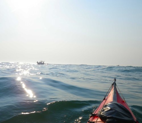
But we were already committed to the right-hand side—nothing to do but paddle onwards and brace ourselves for the first big wave. It hit me with a shock, and then I was riding the up-and-down, up-and-down, motion of the ocean swells.
We passed fishermen lined up along the sides of the inlet, and several motor boats fishing in the center. We were almost through the inlet when I saw a man and a woman on a boat. The woman was holding up a large fish—easily two feet long, and clearly just caught—as the man took a photo of her.
“Congratulations!” I yelled. “Thanks!” the woman replied.
And I realized that I was feeling confident and comfortable enough to pay attention to my surroundings—not worrying about the waves.
Then the inlet widened, the waves subsided, and we were out in the Atlantic.
We turned left and started to paddle.
And paddle.
And paddle.
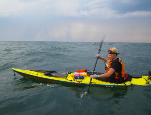
 Nothing to feel but the constant up-and-down, up-and-down of the swells. Often they were high enough to hide us from each other—even the tip of Vlad’s yellow hat disappeared from sight. But they were fun to ride, and at times even surf a little.
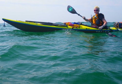


The sun rose higher, and we admired the houses along the shore. As we got into the Hamptons proper, the houses got bigger, and spaced father apart. I wondered idly why so many of them had an odd number of chimneys: one, three, five, seven or nine? Is there some secret equation that links odd numbers of chimneys with luxury?
We paddled some more. Out of nowhere, a bee appeared, aiming for my face. I blew it away.
We paddled some more.
Then after about ten miles, I wanted to take a photo of Vlad. I reached into the pocket of my yellow PFD for the camera. But when I took it out, something was wrong. The display was the “white screen of death”—blank—and the camera was buzzing. I’d never heard a camera make that noise before.
I shook it, and rebooted it, and stared into the display once more. Nothing happened. Then suddenly I felt a tickling on my neck—followed by a sharp sting.
“Ouch!” I yelled, and slapped my neck.
Then I realized what had happened. The bee that had flown toward me before had managed to crawl into my PFD—and came out when I reached for the camera.
Improbably, the bee had stung me just as the camera decided to go belly-up!
Fortunately, I’m not allergic, and the pain of the sting faded after a few minutes. But it wasn’t the last bee attack of the day. Later on, one launched itself at Vlad’s yellow hat (he tried to dislodge it, but it wouldn’t leave, and in the end he had to drown it). And another one tried to camp out on my yellow water bottle.
We later recalled that bees like the color yellow—and acknowledged that, with all the things we’d worried about, we’d never once thought to worry about bee attacks! Fortunately, the dreaded sharks never materialized—and the bee attacks were the worst we’d experience on the trip.
We paddled on, along the long sandy beach, up and down, up and down on the swells as they swept under us toward shore, periodically hiding it from view.
The next excitement was a couple of hours later, when we rafted up so I could take a refreshing dip in the ocean. (Okay, jump out of the boat and pee.) Experienced paddlers know this isn’t really a good idea. Getting out of the boat always introduces some small risk. But we’d done this a couple of times before, and didn’t think there would be any problem.
To get back into the boat, I used the BCU-recommended re-entry method (starting on my back and rolling into the cockpit) while Vlad stabilized the boat. But just then a big steep swell sloshed against the side of the boat—and by the time I was in the boat, it was mostly full of water.
No problem, I’d just pump out the boat. Except…. as I was pumping away, with Vlad holding the boat, another big swell hit, dumping even more water in the boat.
Uh-oh.
This clearly wasn’t going to work. We looked at each other. What to do? I tried bailing the water out with an empty water bottle, but that worked no better than the pump.
Finally I figured out how to put on the spray skirt, tuck the pump in under my waistband, and pump from inside the spray skirt. That got the water level down far enough that, after a few minutes, I could pump the rest of the water out the normal way.
No harm done—but it was a clear reminder not to take unnecessary risks. No more “refreshing dips” in future—not until we were safely out of the swells.
We paddled on…
 Periodically, Vlad checked the GPS to see how far we had gone since Shinnecock Inlet. 10 miles… 15 miles… 20 miles! And just then, we passed a brightly-colored cluster of balloons that said “Congrats!” :-)
The next stop was for a late lunch, around 4 PM. We rafted up and had some coconut cream, fruit, and almonds. By then we’d gone 25 miles—still another 10 or so to go. But we were slowing down: the swells, now coming at a slightly different angle, were no longer helping us. The day was still hot and bright, but clouds were massing to our left, over Long Island.
“I’m worried about finding a camping place after we round the point,” I said.
“Well, I’m worried about not getting to the point before the current turns at night,” Vlad replied. “If we don’t make it there by nine, we won’t make it around the point at all. And since we can’t land, we’ll have to paddle all night.”
Yikes.
Paddle all night, after paddling 35 miles? Navigate in the dark? I resolved to pick up the pace.
And I did. I mentally divided the number of miles left to go into tenths, then ticked off the tenths on my watch. And I adopted a hard-soft sprinting strategy: for one minute I paddled as hard as I could, and for the next minute I paddled slower, but with perfect form.
Slowly the remaining miles began to tick away. Ten… nine… eight…
At mile eight we heard an ominous bang.
“What’s that?” I asked.
“Maybe fireworks?” Vlad replied hopefully.
“Fireworks,” we agreed. After all, it would be the Fourth of July in a few days.
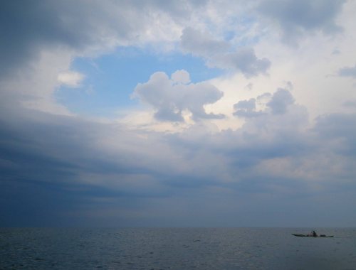
 But at the next rumble, we couldn’t deny reality any longer. What we’d heard was thunder. And the clouds were massing blackly to our left.
Then the first lightning bolt hit. I counted the seconds: One-one-thousand, two-one-thousand… The storm seemed to be about ten miles away.
The thunder and lightning grew more intense. Above us, the sun was still shining, but the sky to our left was filled with darkness. Darkness that was increasingly lit up by lightning.
We looked at the shore, but it was impassable: tall waves crashing into the base of red cliffs. We’d reached the part of Long Island where the surfers go out to play—and it was no place for (our kind of) kayakers to be landing.
By the time we were about three miles away from Montauk Point, though, it was clear that we’d dodged the bullet. The thunderstorm was passing us, moving ahead, out to sea.
Whew!
 We slowed down the pace a little bit, and admired the striking red cliffs to our left. Just a couple of miles left to go….
… And then we heard it. More thunder, this time from behind us. A second thunderstorm, even bigger and more powerful than the first, was heading our way.
Once again, lightning flashed and thunder cracked—and this time it was getting very close.
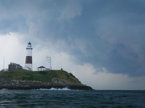
We could now clearly see the lighthouse on Montauk Point, bright white against the lowering clouds. It was a picturesque scene, straight out of Norman Rockwell’s New England.
I would have appreciated it a whole lot more had it not been for the approaching storm. After a few more minutes, it was clear that we weren’t going to escape this time. This storm was going to hit.
We paddled harder.
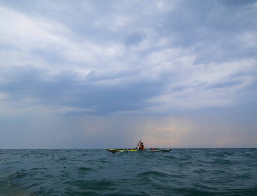
And just as we reached the very tip of Montauk Point—the easternmost point of our entire trip!—the storm hit. We later agreed it was a perfect Hollywood-choreographed moment. All at the same time, powerful gusts of cold wind swept down, a cold rain started, and the waves began breaking fiercely. Lightning flashed down all around the horizon. And off to the left, the clouds parted to show an orange setting sun. Over to the right, meanwhile, a full moon was rising.
Sunset, full moon, storm—all in the same moment!
But I couldn’t properly appreciate the visual drama—I was too busy keeping my boat from capsizing. In the powerful gusting winds, it was everything I could do to avoid being blown backwards. And with the waves rising up and breaking all around, I was edging and bracing to the best of my ability. I was making no progress around the point, and the wind and waves threatened to push me over.
Remembering the difficulty I’d had getting into and emptying out the boat earlier, I was getting concerned. A capsize-and-rescue under these conditions would be challenging, to say the least!
Vlad had paddled on, around the point, but when he saw the difficulty I was in he came back toward me. “Don’t worry!” he shouted. “It will be over soon!”
He was right. The fierce wind only lasted a few minutes, and when it lessened a bit, I was able to make headway. The waves were still choppy, but much less threatening.
And slowly, slowly, we rounded the point. Vlad took pictures, and I just paddled.
Slowly the thunderstorm pulled out to sea and the clouds opened up—and, lit by the setting sun, put on quite a show!
But what was that? Not a third thunderstorm, behind the other two?
Yep.
“If this storm hits, we make straight for shore,” Vlad said. He was right: we were on the protected side of the point. The surf on this side of the point was much smaller, even though the sea was still rough from the previous storm.
But fortunately, the third thunderstorm passed us by, and we found ourselves paddling through slowly calming waters, looking for a possible campsite as the sun set.
A couple of miles round the back of Montauk Point, we located a friendly-looking beach, and went in for a landing.
But we’d misjudged: Although it looked peaceful enough, there was a steep ledge just underwater, and we landed in small but dumping surf. My boat ended up half filled with water, but fortunately I avoided getting pounded. I emptied the water out, and we dragged our boats up the beach, which was rather steeper than we were hoping it would be, grumbling and complaining at the effort.
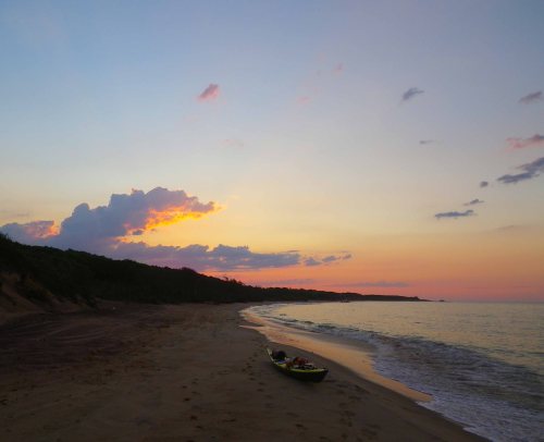
After 35 miles and 13 hours, we were around Montauk Point and safely ashore! And the views all around in the last light of the setting sun could not have been more magnificent…
Before it got too dark, we still had to find a campsite. And we soon found the perfect spot: a grove of trees on a firm, peaty embankment, elevated about eighteen inches above the back of the beach. Sure to be safely above the high tide line, in other words. We promptly dubbed it “Pleasant Grove”.
After just a bit more effort—we had to trail the boats through the water a hundred yards from where we’d initially landed, then completely unload them to be able to lift them onto the bank—we were there! We made camp. Too tired to cook, we shared nuts, salami, and cheese before tumbling in to sleep, as the full moon rose high over Pleasant Grove.
The ground under me kept going up-and-down, up-and-down… But we’d made it!














Pingback: Long Island Kayak Circumnavigation: Day 4—To Shinnecock Inlet | Wind Against Current
Wow! What a trip, eh?!
LikeLike
Indeed! :-)
LikeLike
awesome post.
LikeLike
Thanks, John! I think you know many of those places…
LikeLike
The storyline was gripping throughout – and had to keep remembering that this was not a fiction. In the midst of it all you managed some awesome images. Thrilling from start to finish – was relieved when you made it to Pleasant Grove. Strange thing about sea bees. You two are inspiring adventurers – and fit too!
LikeLike
Johna knows how to tell a good story! And I do like to take photographs :-)
LikeLike
Wow! Dramatic! This got my adrenaline going. Since you were writing about it I knew it worked out OK for you in the end, but still…wow!
LikeLike
… but the trip is only half over… ;-)
LikeLike
The sun rising, clouds, sun set, and moon were just magnificant! Wow!!
13 hours of long and hard paddling… you guys must be totally exhausted at the end of the of the day.
LikeLike
We weren’t all that tired, actually—back home in NYC, we often paddle a lot farther and a lot longer in a day (those are day trips, however). But it was a very intense day, in its variety of experiences coming one after another. And the thunderstorms at the end were exhilarating: we were having fun—once it became clear we weren’t actually going to die… ;-)
No, on this trip it was never the paddling that tired us out—it was the chores of setting up camp and especially packing up in the morning. (More on that in future posts.) We were always happy to be back in the boats and paddling on…
LikeLike
What a great adventure, thanks for sharing with us land-lubbers, MJ
LikeLike
Thanks, MJ! :-)
LikeLike
Reblogged this on " Una Voz en el Silencio ".
LikeLike
Thanks for reblogging!
LikeLike
Thanks is beautiful !
LikeLike
Beautiful photos. I used to visit Montauk when I was a kid. Kayaking looks much more fun than the Long Island Expressway.
LikeLike
We’ve tried the Long Island Expressway, and we’ve tried kayaking, and kayaking is better…
Glad you like it! :-)
LikeLike
What an adventure! loved the lighthouse.
LikeLike
We were very happy to see it too!
LikeLike
Really stunning photos!
LikeLike
It was a really stunning day…
LikeLike
I love reading about your kayaking trips, and I love all the pictures. Thank you.
LikeLike
Thank you! Only half-way through the trip—more to come…
LikeLike
Phew – what a day filled with adventures (and mis-adventures) and such incredible beauty and wide open skies, and the expanse of the ocean all around you so you can see everywhere that was far away … really, what an adventure you’re recreating for us to follow :)
LikeLike
So glad you are following—thank you! :-)
LikeLike
Now, I wonder if I’ll have time to pop over and see if you’ve posted Day 6 before the power goes off?
LikeLike
Not yet, sorry! These photo challenges do so get in the way… ;-)
LikeLike
Laughing! Especially when they’re so challenging, or alluring – how can one stop at one sunset post for instance?
Power cuts continue all week, but I’ll get over there sometime, you can be sure …
LikeLike
Funny you should mention the sunsets… how can one stop at just one sunset? So I just posted seven :-)
LikeLike
Ahhha! :)
LikeLike
I am honored to nominate you for The Liebster Blog Award! Please pick-up your award at . http://nackynice.wordpress.com/2012/08/14/the-liebster-blog-award/ Copy and Paste the Award to your blog and follow the rules of acceptance. I wish you many blessings. Congratulations!!
LikeLike
Thank you so much for nominating us, Nizy! We are honored… We will post about this award as soon as we can :-)
LikeLike
Lovely shots!
LikeLike
Glad you like them—thank you!
LikeLike
You know, for a while there you guys were making this trip look easy. This was the most exciting leg to date. Not sure I’d make it 12 hours uninterrupted in a boat!
LikeLike
It certainly was exciting! Thanks for reading…More to come!
LikeLike
The photos are so beautiful! My employer has a house in the Hamptons; I’ll ask about the chimeys. And very glad you paddled through and were able to relay your adventure!
LikeLike
It’s fun putting together these posts, now at some remove… reliving it again! :-)
LikeLike
Great trip report wit dramatic photos . What model GPS have you been using ?
LikeLike
It was just a little Garmin eTrex, the old style they don’t make any more. (Johna has a more elaborate mapping GPS but still nothing fancy.) I hardly ever have occasion to use the GPS for true navigation, but use it mostly as a speedometer and distance marker. So I figure I should get the cheapest one possible because sooner or later I will lose it or it will die and I will have to replace it. And indeed…. see next installment! :-)
LikeLike
What a great trip!
LikeLike
… more to come!
LikeLike
a breath taking challenge!
LikeLike
breathtaking challenge!
LikeLike
Thank you very much!!
LikeLike
Congrats on your adventure! The captured sky is breathtaking.
LikeLike
Thanks, Paula! More to come…
LikeLike
Pingback: Long Island Kayak Circumnavigation: Day 6—Across the Forks | Wind Against Current
wow, the photos and the tell are incredible .. I love the photos of the light house ..
LikeLike
Thank you! That was definitely the high point of the trip, although each day had its own particular experiences… take a look at the others! (We are still working on Days 8-10…)
LikeLike
what you have posted so far is amazing, I will keep an eye on that
LikeLike
Wow, Johna & Vlad, what an epic day – glad you made it safely. That day, you paddled right past my stomping ground at Flying Point Beach in Water Mill.
LikeLike
I’ve just looked up where that is… In fact, we noticed that stretch of beach especially! We weren’t quite sure how far we’d gone since Shinnecock Inlet, since the coastline all looked much the same, but at that point it appeared that there was a large pond behind the beach, the first large one we’d come to… so we knew where we were on the chart! (Of course, we could have just looked at the GPS, but that would have been cheating…)
LikeLike
Just seeing this now – EPIC!
LikeLike
Felt that way, just a bit… :-)
LikeLike
Pingback: A Word A Week Photo Challenge — Cloud, Take Two | Wind Against Current
What a great story and fabulous pictorial. You are both so brave! I have a deathly fear of deep water so this story captured frame by frame was pretty enthralling to me..
LikeLike
One thing you learn pretty early on in kayaking is that once the water is more than a few feet deep it doesn’t really matter how deep it is, and once you are more than a hundred yards from land it doesn’t really matter how far you are…
Thanks!! :-)
LikeLike
OH MY- easy for you to say but I will live vicariously through both of you!! :)
LikeLike
Plan on it! We’ll keep bringing you that scary feeling ;-)
LikeLike
I love the edge- THANKS : )
LikeLike
Pingback: Our 2013 Calendar | Wind Against Current
I rolled the page until here… just to say you have a wonderful hobby ; )
LikeLike
We certainly think it is! :-)
LikeLike
I’ve had a few days like that. Ultimately tired in my tent after surviving some of Mother Nature’s best efforts on the water.
LikeLike
I am sure you have! This (Day 5 of our trip) was actually a lovely day—definitely not anywhere close to Mother Nature’s worst… That’s part of what I meant by the difference between kayaking on the East and West Coasts. Long Island in the summer is a very benign place…
LikeLike
I just finished reading the remaining posts of the trip. I’m sold! Though here in the Gulf Islands the summer paddling is also very benign, some of the outer coastal stuff I have done can be a lot different. One of the best winter paddling days I ever had out there was in August! Great posts, and the photos really tell the tale.
LikeLike
Thanks for reading it all through!! It was a lovely trip. None of the bad things that we imagined (mostly having to do with the fact that Long Island is densely populated) came to pass, and we were amazed at how wild, at least around the fringes where we were, Long Island really is… :-)
LikeLike
Pingback: Weekly Photo Challenge: Escape | Wind Against Current
Pingback: Weekly Photo Challenge: The Golden Hour | Wind Against Current
Pingback: Weekly Photo Challenge: Grand | Wind Against Current
What an adventure! What an experience!
My travel blog is much more calm! Thanks for visiting and liking!
LikeLike
We usually try for more calm too, but sometimes it just doesn’t work out that way ;-)
LikeLike
Pingback: Time | Wind Against Current