By Vladimir Brezina
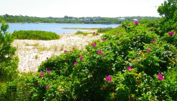 Block Island lies in the middle of Block Island Sound, about ten miles south of the main Rhode Island coast. It’s a fairly large island, beautiful in the coastal New England manner, with long sandy beaches, grassy dunes and bluffs, beach roses and beach peas, warm turquoise waters. (This is in the summer, of course… although in winter, when the tourists and the summer residents leave, the windswept, largely treeless island no doubt has its own bleak beauty too.) There are some paddling possibilities on the island itself.
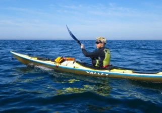 But, to my mind, the main point of Block Island is to paddle out to it and back again.
A distinct step up from the open-water paddles across New York Harbor’s Lower Bay or across Long Island Sound, which are still fairly sheltered, the Block Island paddle offers true open-ocean experience. The open water of Block Island Sound is exposed from all directions, but particularly from the south—any conditions out on the open Atlantic will be felt, with little attenuation, in the Sound. There is nowhere to hide from them. On the other hand, the paddle is not so long, and many days in the summer are predictably benign. So this paddle will test mainly your navigational skills and your critical judgement about weather and tidal currents—but, if that judgement should fail, also your rough-water paddling skills…
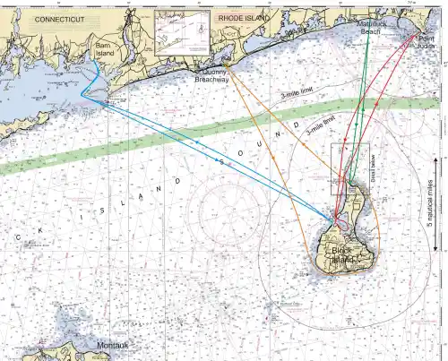
Over the past decade, I’ve paddled out to Block Island, and back, four times (as shown by the colored tracks on the chart below), starting from various points on the mainland coast. The shortest one-way distance is about 8 nautical miles, from Point Judith, Rhode Island.
(click on chart to expand)
Weather. In the summer, there are often long stretches of calm and settled weather, so it’s not too difficult to pick a day on which the prevailing wind will be mild. But in the afternoon of such a day a sea breeze is likely to develop. On the open water, even moderate winds can produce challenging waves. And even on the calmest day, you can expect two- or three-foot swells rolling in from the open Atlantic.
If you paddle out to the island and the conditions then deteriorate, you might be able to take the Block Island Ferry back to Point Judith.
Navigation. On a clear day you can see Block Island, albeit very low on the horizon, from the mainland, and vice versa. But summer days are often hazy, and you might have to start out without seeing your destination. And it can get worse. I remember paddling through Block Island Sound on a day when smoke generated by a major forest fire in Canada reduced visibility to less than a mile (and imparted to the water and air an eerie orange glow), so that I paddled all day without seeing land… A chart and compass are essential, and a GPS preprogrammed with waypoints will take most of the worry out of the navigation—provided it works!
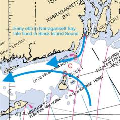
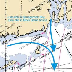
Tidal currents. The trip can be markedly assisted by tidal currents. But the currents are complicated. The currents between the mainland and Block Island set predominantly east-west. But the currents into and out of Narragansett Bay, just to the east of the Point Judith-Block Island route, set north-south, and precede the Block Island Sound currents by two hours or more. Altogether, this produces roughly these current flows:
So, while the trip is across more than with the currents, nevertheless by leaving Point Judith, for instance, at the start of the ebb in Narragansett Bay (as in the first chartlet above) you can get a significant push south and west to Block Island. Then by leaving Block Island at the start of the flood in Narragansett Bay (as in the third chartlet), you can get a push north and east back to Point Judith. This, at any rate, is what we did on our last trip to Block Island (photos below).
I have not checked this picture of current flows very systematically, however—so before you go, be sure to check that particular day’s current predictions (for instance, at the points A, B, C, and D marked on the first chartlet; predictions at these locations can be found here, here, here, and here, respectively).
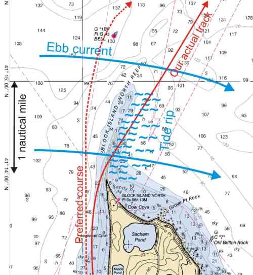
Tide rip. From the northern tip of Block Island, a shallow reef, Block Island North Reef, stretches to the north for more than a mile. The ebb current in Block Island Sound accelerates to 3 knots or more across this reef, and a sizable tide rip develops. The safe paddling route would be to the west of green buoy “1BI” that marks the northern end of the reef (see chart below). On our last trip, however, we had to maneuver between numerous boats fishing in the smooth water just to the west of the reef, and before we knew it, we were swept into the tide rip. It was quite bouncy!
Here are a few photos from our last trip out to Block Island, in July 2011 (red track on the charts).
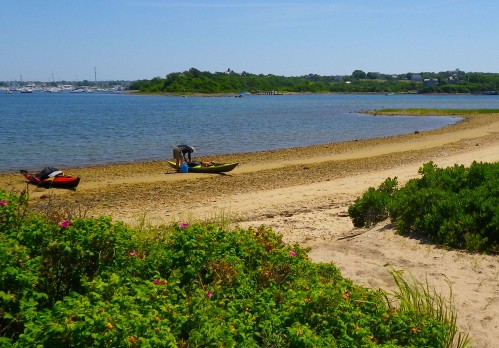
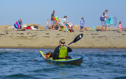
We launch at Point Judith. With a little trial and error, down an unmarked dirt road we discover a convenient parking lot right at the foot of the eastern breakwater of the Point Judith Harbor of Refuge. We can launch right there, but outside the breakwater off rocks, or after a short portage from a nice, calm, sandy beach inside the breakwater (see the last photos below). We opt for the latter…
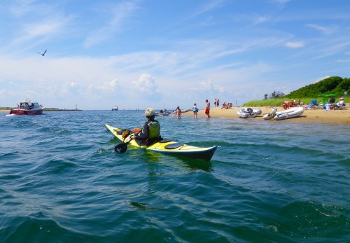
We paddle out of the Harbor of Refuge. The open Block Island Sound is unusually calm today…
 There is the usual summer traffic, although the open Sound is so vast that there is little danger of collision.
However, we do get a little nervous about the Block Island Ferry, which follows us out of Point Judith for some distance before diverging to New Shoreham on the east side of Block Island, whereas we head to the west.
We are in international waters!—outside the three-mile zone around the Rhode Island coast, but not yet in the three-mile zone around Block Island (see main chart above).
The bluffs of Block Island are now clearly visible…
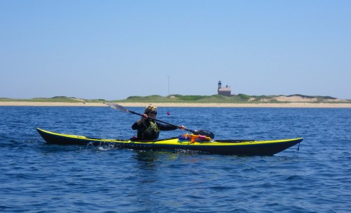
And then we are there! We paddle along the long beach on the northwest side of the island, past the low grassy dunes and Block Island North Light behind…
… and turn into the Great Salt Pond, a large pond that occupies the middle of the island.
We land for lunch in a shaded pine grove…
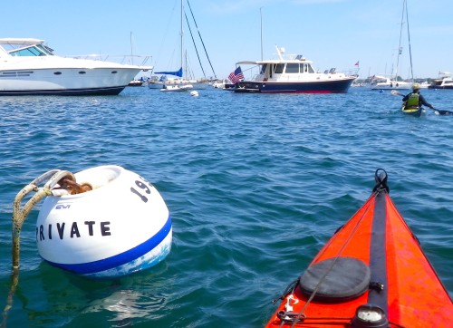
After lunch we take a tour of the Great Salt Pond, which is a harbor filled with a myriad craft at anchor.
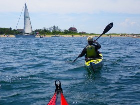 Finally it’s time to leave the holiday atmosphere of the pond and head out to the open sea again.
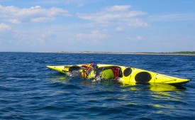
Johna practices a few rolls in the warm, crystal-clear water.
.
Then we head back north, back along the long beach and past the lighthouse…
… over the reef and through the tide rip that is off the north tip of the island (photos not shown ;-) ), and across the eight miles of Block Island Sound …
… back to the beach inside the Point Judith Harbor of Refuge that we started from.
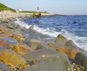 And, after loading the kayaks back on the car, there is still plenty of time to enjoy the view of the picturesque rocky shoreline outside the breakwater that leads up to Point Judith Light, now bathed in the late afternoon sunshine.
.
Good luck and good paddling during your own trip to Block Island!
________________________________________________________
More photos, from this day and the other days of our 2011 New England paddling vacation, are here.















can’t paddle to Block, but enjoyed your trip vicariously, thanks MJ
LikeLike
You are welcome, MJ! That’s why we post these trips!
LikeLike
What a trip, I love Block Island and stayed at the Narragansett on the Great Salt Pond last summer. How long does it take, on a good day, to paddle across?
LikeLike
Across the open water itself, with the current, just a couple of hours each way. But then if you want to go further on Block Island, visit the Great Salt Pond, have lunch, etc., as we did, it becomes an all-day trip.
LikeLike
What a great day trip! I think I could paddle that far, but the possibility of getting “lost” and paddling out to sea would intimidate me.
LikeLike
Well, it’s not that far, and (as with kayaking in general) it seems deceptively easy, but this is a trip on which you could get into a world of trouble (quite apart from not finding the island and getting lost at sea). Unless you are an experienced kayaker—experienced enough to know what you are getting into—I would not recommend it.
LikeLike
I kayaked from Montauk Harbor to Block Island last summer by kayak with a friend, stayed a few nights at the Narragansett Inn, and then took the ferry back. They ferry charged a kayak like a surfboard, and it was only $10 or $20. So cheap I did not pay attention. Fun trip.
LikeLike
Thanks, Richard, that’s useful information!
Yes, the Montauk to Block Island route seems to be quite popular with kayakers and even SUPers. I haven’t done it myself.
Concerning taking a kayak on the ferry: the Montauk-Block Island ferry is operated by a different company than the Point Judith-Block Island ferry, I believe, so what applies to one doesn’t necessarily apply to the other. However, I’ve heard of kayakers paddling out to Block Island from Point Judith and then taking the ferry back (admittedly, this was some years back). The “traditional” ferry, at least (as opposed to the “high-speed” ferry) takes cars and all kinds of freight—and surfboards are explicitly listed—so something should be possible.
LikeLike
I enjoyed your post. My husband and I vacation on Block Island every summer. We have never Kayaked. One of these days…maybe.
LikeLike
Glad you enjoyed the post—thanks for your comment!
LikeLike
enjoyed.. : )
LikeLike
Thanks for letting me know! :-)
LikeLike
What an awesome adventure! Thank you for sharing information about this island. I am not so brave to kayak.
LikeLike
Definitely worth visiting, by kayak or otherwise! Similar to Martha’s Vineyard, but more low-key, less pretentious….
LikeLike
And it appears that the Block Island crossing has also been swum (!), in 2005 by Jim Bayles. He thought he was the first, but as he mentions in his writeup he subsequently discovered that years previously there had been some kind of organized event in which at least two other swimmers made it across.
In his writeup, Jim also describes the tidal currents between Point Judith and Block Island and the difficulty they pose for swimmers, who move even slower than kayakers…
LikeLike
Pingback: Kayaking Gold on Cape Cod Bay | Wind Against Current
Pingback: Sea Kayaking Adventures in New England: A Few Photos to Start With | Wind Against Current
Great post packed with charts. I am a kayak angler and was googling Kayaking Block Island, as it is a mecca for Striper fishing. Not sure if I can kayak across the ocean on my sit-on-top though.
LikeLike
Probably not a good idea. Some sit-on-tops are perfectly ocean-worthy (viz: surfskis), but probably a fishing kayak with all the fishing gear would not be ideal. Try going across on the ferry? Good luck!
LikeLike
Hi! A friend of mine and I have started floating out to the sea from Narrow River on boogie boards. I have never kayaked before and would like to get into it. Where is a good place to start? Thanks.
LikeLike
If you’ve never kayaked before, probably the best way to start is to go to a local kayak store and take a lesson. Even one lesson will give you an idea of the basics—what to do, what not to do, what kind of equipment you need, etc. You can figure it out on your own, but you will start by making all kinds of mistakes which even a single lesson will help you avoid. Good luck and have fun!
LikeLike
Thank you for the terrific write up.
I’m researching a bike-camping trip from NYC to Boston via the southern shore of Long Island and the sound. Do you think it’s possible to go from Orient Point to Fisher’s Island to Westerly Rhode Island in a packraft? Any guesses how long this might take (with bike and gear atop)?
LikeLike
Hi, Matthew,
Looking at the map, that route looks tempting, doesn’t it? And, of course, it’s doable. However, it’s definitely not advisable unless you really know what you are getting into and have expert skills. That would be true even in a sea kayak, but goes triple for a packraft.
You basically want to go from Orient Point to Plum Island (where landing is not permitted) to the Gull Islands to Fishers Island to, finally, the mainland of Connecticut / Rhode Island. The problem is that through the passages between those islands flow all the flood and ebb waters of the entire Long Island Sound during each tidal cycle. Currents can reach up to 5 knots, with sizable tidal rips and standing waves. The Race, between the Gull Islands and the southern tip of Fishers Island, is notorious. It’s a favorite rough-water training ground for kayakers. Here is a video of the rough water in one of the less-rough passages ;-), to the north of Fishers Island:
Ideally, you’d want to time your crossing so that you cross at slack water. I don’t know how fast you can move in a packraft, but I would guess not as fast as in a sea kayak. So the chances that you would be able to cross all the way (several miles) across the Race while the current remains moderate are small. You have to assume you will have to deal with some of the rough water. And of course that’s even more true for the entire trip across all the passages. You’d probably have to break that route into several pieces and wait it out on shore in between.
The saving grace is that, if you do capsize, you will quickly get flushed out into water that is less rough (unless there is a lot of wind). You should therefore probably go when the current will next flood, so you get flushed into Long Island Sound. In the other direction, you will get flushed into Block Island Sound and could be miles from land in no time.
I don’t know what your experience is with packrafts, how fast you can paddle one, how stable it would be with your gear and bicycle, how sensitive to wind, etc. But these are all factors to consider.
Do I sound too discouraging? Sorry, but that was the idea. That way, if you go, you will know what you are getting into.
If in doubt, take the Orient Point ferry :-)
LikeLike
Pingback: Birthday paddle to Block Island | Have Kayaks Will Travel
Hi Vladimir,
I discovered your blog when researching Paddling from CT/RI to Montauk NY. I paddle an Ocean Kayak Trident Ultra 4.7. She’s a 15′ long Sit On Top designed for serious Offshore fishing. While I’ve done beach launches and landing off Fire Island and paddled the coast of Fire Island, I’ve never done a crossing like this.
I’m looking to team up with some experienced kayakers and try to make this trip a reality in August or September of 2014 before the water temps get too cold.
Any interest? If not, any tips?
Larry Jensen
aka Waterdawg
http://www.LifewithLarry.me
LikeLike
Hi, Larry,
I’ve done trips between CT (specifically, Stonington) and Montauk, and between the RI coastline and Montauk (in addition to the trips to Block Island described in this post), so I know that area reasonably well.
The main thing to consider for a trip from CT/RI to Montauk—apart from the weather, of course—is the tidal current. You want the catch the ebb coming out of Long Island Sound (and the flood if paddling from Montauk to CT/RI, of course). To make best use of the current, you probably want to start as far East as possible, i.e. in CT rather than RI. If you start in CT, it’s particularly important to have the current with you in the passage between Fishers Island and Napatree Point. That passage can get a bit turbulent (see the video in my reply to a comment just above yours), and there will be tide rips in a few other places, but nothing too bad.
Johna and I are actually thinking of doing a similar paddle, as part of the “Stonington Triangle”: Stonington to Montauk, then to Block Island, then back to Stonington, in one day. That probably won’t happen soon, however, since it’s a trip we have to plan for somewhat seriously, and we already have a lot going on this summer…
Nice blog, BTW! :-)
LikeLike
Hi Larry,
I”m working my way through your blog now, starting from the beginning.
Wow, it’s fantastic!
Quick question: On the Thanksgiving entry, you write: “If you subscribe to our blog, and I hope you do, you will see an upcoming Kayak Trip Lexie and I will embark on from the Genesse River in Rochester to the Erie Canal south to Albany and perhaps down to Manhattan.”
Did you ever do that one? Let us know if you do. We can put you (and Lexy) up in Manhattan and maybe find a place to store your boat.
Okay, back to my blog reading!
LikeLike
Thank you for taking us along with such beautiful photos, everything looks fun:)
LikeLike
You are most welcome! I am so glad people are reading these old posts :-)
LikeLike
Wow! What an amazing adventure :)
LikeLike
Yes, this trip can turn into an adventure ;-)
LikeLike
Beautiful! Open ocean, you are brave!
LikeLike
What can go wrong? ;-)
LikeLike
Hi Vladimir. I enjoyed this post because we have sailed in the area of Long Island Sound and BI Sound for many years. You must really pay attention to tides, currents and weather as you discussed. It’s not uncommon for the fog to roll in on a calm day, as well as thunderstorms to develop. Thanks for your post!
LikeLike
Thanks, Karen! Love your blog! And thanks for following ours!! :-)
Yes, the eastern end of Long Island Sound and Block Island Sound are challenging areas for kayakers. For kayakers especially—given their low speed, they are much more at the mercy of the currents and other conditions than are those in bigger boats. And the currents are not all that well predicted, certainly not with the fine geographical graininess that kayakers would like, and of course they change with the weather. The best defense, in addition of course to doing the preliminary research, is to have a lot of extra power and endurance so that, if you have to paddle all night, you can. You really don’t want to be paddling out to Block Island if that is the extreme limit of your range…
LikeLike