By Johna Till Johnson
Photos by Vladimir Brezina
<—Previous in Everglades Shakedown
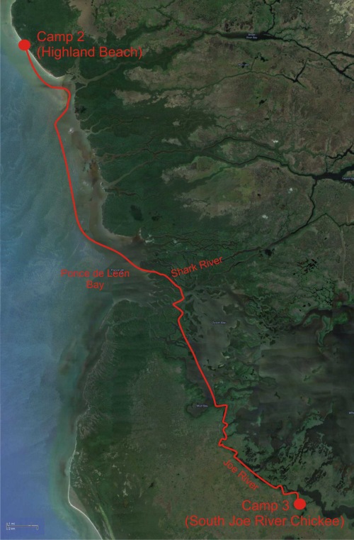
Start: Highland Beach.
Finish: South Joe River Chickee.
Distance: About 23 nautical miles.
Paddling time: Roughly 10 hours; average pace 2.3 knots.
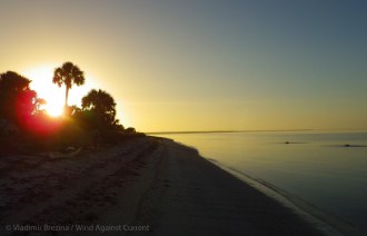
We awoke to the early morning light filtering into the tent. Hard to believe we’d been able to sleep after surviving last night’s mosquito assault.
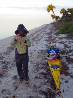
Remembering that, it took us a little while to work up the courage to jump out of the tent. But this morning was different. Before venturing out, we pulled on our paddle jackets and pants. Together with hats, gloves, and face nets, the clothing provided a pretty good bug barrier.
Not good enough to test by sticking around to make breakfast, however! We decided we’d paddle a few miles, then eat on the water. No sense in tempting fate (or clouds of mosquitoes).
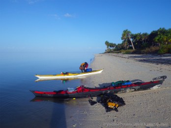
Just as we were taking down the tent, we saw the couple from last night glide by in their canoe. We waved, and a thought bubbled up at the back of my head: Was there some reason they were getting such an early start? Experienced campers often do, to take advantage of the calm, early morning hours (and to arrive at the destination before the onslaught of bugs).
But wasn’t there also some weather predicted for the day? I vaguely remembered that, back when I rented my kayak, Russell made some comment about a storm front heading through…
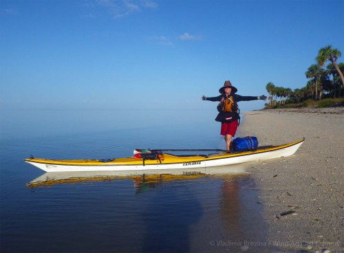
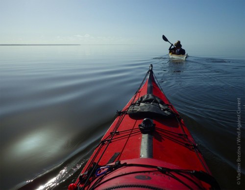
But the morning was clear and perfectly calm, and the sky was open and blue. I put the thought out of my head, and we launched without incident. Today was the start of the open water portion of our trip!
We headed off down the coast, toward the distant blue capes that we could see low on the horizon.
.
.
.
.
After a while, we paused for a sip of water and our belated breakfast, relaxing in our boats on the mirror-still water.
… What was that? A dolphin? But the fin sliced too steadily through the water…
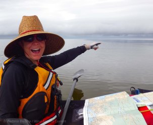
“It’s a shark!” Vlad announced. Indeed it was—a small one, to be sure.
And according to the charts, we were just off something called “Shark Point”. Between Alligator Creek and Shark Point, the Everglades were certainly delivering as promised!
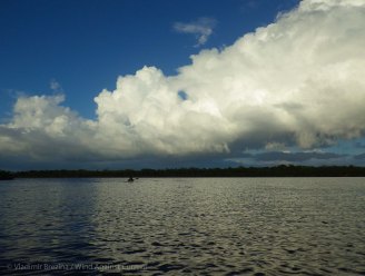
Then I happened to glance over my shoulder, the direction from which we’d come. A solid line of gray clouds was advancing toward us, with occasional vertical columns of white. I hadn’t seen anything like it before…. Uh oh—this was more than just a brief squall!
Fortunately, we’d both brought VHF radios, so we turned on the weather channel and listened while we munched. Sure enough, a storm front was moving through, with a prediction of high winds (20-25 knots) and 3-5 foot seas later in the afternoon and into the evening. The wind was predicted to blow all night, and well into the next day.
It was nothing we hadn’t paddled in previously, but such conditions could make it difficult to land on, or launch from, coastal campsites… (We found out later that our friends Doi Nomazi, whom we met on Day 1, followed the coastal route and were indeed trapped on land for some time by the winds.)
We debated for a few minutes, then decided: We’d go back “inside”. The mangroves would shelter us from the wind and the waves, and there were several possible campsites along the way. We hadn’t reserved them, but surely we’d find something.
So we turned left and headed for Ponce de Leon Bay, and the mouth of the Shark River which would take us back inside. Now we understood why our canoeing neighbors had made such an early start…
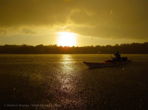
But shelter was still some miles away. Soon the dark clouds of the front overtook us. The wind steadily picked up, and the waves coalesced into long, rolling sets. They were coming at us crosswise, making for some exhausting (though not dangerous) paddling, particularly as we went over the numerous shoals of Ponce de Leon Bay. I was having some trouble with the skeg on my boat, so had to rely on edging and bracing, but Golden Pony Boy was a joy to handle (though I later discovered the seat had cut some nasty abrasions into my hips). Vlad’s Red Herring sliced neatly through the waves, as always.
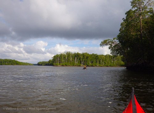
Finally we surfed into the Shark River and were in calm waters again—though paddling, once again, against a strong current that was coming down the river. (I later calculated we’d been paddling against the current at least 90% of the trip, which seems hard to believe—but the push and pull of the waters through the mangroves follows a mysterious pattern!)
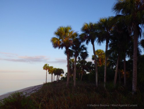
From then on, it was another day much like the previous one: Water, mangroves, sky… water, mangroves, sky. Sheltered by the mangrove forest, we no longer felt much of the wind.
.
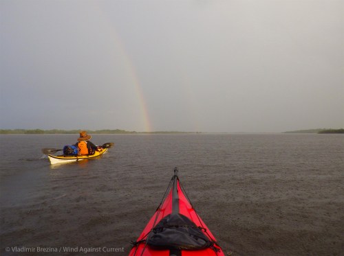
Today, there were also other sights to be had. I caught a glimpse of a sea turtle. And late in the afternoon, we were treated to a brief rain squall and, following it, the wonder of a double rainbow. (Actually, technically, a “twin
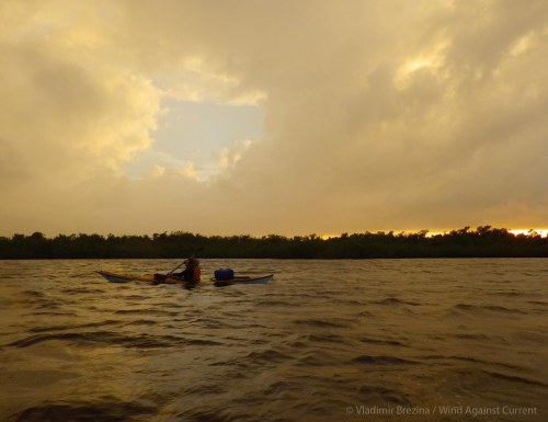
rainbow”. I still can’t get over the poetic fact that it was scientists from Disney’s research facility in Zurich—and yes, there is such a thing—who discovered the physics behind a twin rainbow. How perfect is that?) Later still, a magnificently colored Florida sunset.
We’d decided to make for the Joe River Chickee as our campsite for the evening. It would be our first chickee, and we were looking forward to the experience. And this time, if all went well, we’d arrive before dark.
Once again, we had some trouble locating it (campsites are just never where they’re supposed to be on the charts!). But we finally found it: A double chickee, tucked away in a mangrove-lined bend of the Joe River. One of the platforms was already taken, and the campers had left some gear on the other platform, as well.
We paddled around it, unenthusiastic. For one thing, the platform seemed to be too close to the mangroves—it was easy to imagine the clouds of mosquitoes that would emerge come dusk. Then there was the matter of the neighbors—and the only ladder was on their platform, which would make loading and unloading the boats challenging, as we’d have to squeeze ourselves and our gear past their tent.
And besides… it was early. Neither one of us really wanted to stop for the day.
We consulted the charts. There was another chickee, South Joe River Chickee, a few miles away, and on our route. It wasn’t close enough to arrive by dusk, but we’d probably make it shortly thereafter…
The dilemma: On the one hand, South Joe River Chickee might be free, and would be a few miles farther on in our trip. On the other, it might be completely full, or we might be unable to locate it in the dark (a real possibility given how flaky the charts were), which would leave us without a place to sleep for the night.
It wasn’t much of a decision: We’d make for the South Joe River Chickee, and if it didn’t work, we’d keep paddling all night until we got to Flamingo, where there was a campground (or at the very least, a parking lot).
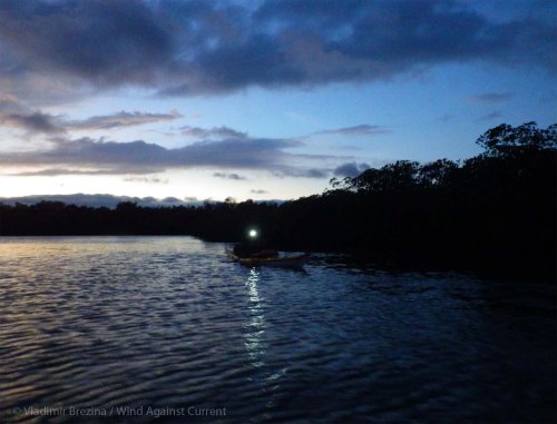
We set off, feeling adventurous, through the glorious sunset.
The paddle to South Joe River Chickee wasn’t long—three or four miles—and it felt even shorter. But as dusk began to close in, I started worrying. Would we find the chickee? Would it be occupied? I kept reminding myself that we had a perfectly fine contingency plan—a night paddle to Flamingo—and found myself actually looking forward to the possibility.
Suddenly Vlad took off ahead of me. “I think this might be it!” he called, as he made a turn into the mangroves. I paddled hard, trying to keep up with the glitter of the reflective strips on his PFD in the darkness. When I caught up to him he’d stopped paddling, and was pointing to something.
“Isn’t that the most perfect chickee ever?” he asked excitedly.
It was.
South Joe River Chickee was positioned well away from the mangrove-lined shoreline, and so was likely to be bug-free. And best of all—it was perfectly empty, with ladders on both platforms!
We pulled the boats up to the ladder and began unloading gear. We tried several methods, none of them very satisfactory. First I stood on the ladder and reached back down into the boat to pull out the gear. But I only had one hand, since with the other I had to hold myself on the ladder. Then Vlad rafted up to my boat on the opposite side and handed me my remaining gear. That worked, but how to then unload Vlad’s boat? Finally Vlad got out onto the platform, lay down on his stomach, and was just able to reach with both hands down into his boat. But that wouldn’t have worked at all if the platform had been just a few inches higher—or the water lower, which was bound to happen as the tide fell.
Finally, we tied the empty boats up to the chickee, attaching them at both ends, with enough line to allow for a few feet in tidal drop.
Then it was time to set up the tent. That was more exciting than we anticipated, since the wind was blowing pretty strongly by now. Fortunately, Vlad carried on his deck a number of spare bungees, and we used them to secure the tent. It flapped and rattled in the wind, but stayed put—particularly with all our gear piled inside.
I set up the JetBoil using the tent as a wind block. Soon we had steaming bowls of stew. We dimmed our headlamps and started to eat, looking out at the stars and dark shoreline. It was warm and (in the lee of the tent) calm, and utterly peaceful.
It wasn’t until then that I realized: Tonight was Christmas Eve.
* * * * *
Here are more photos from Day 3 (click on any photo to start slideshow):
Even more photos are here.


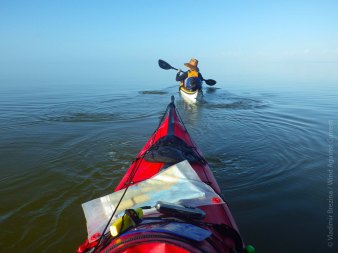
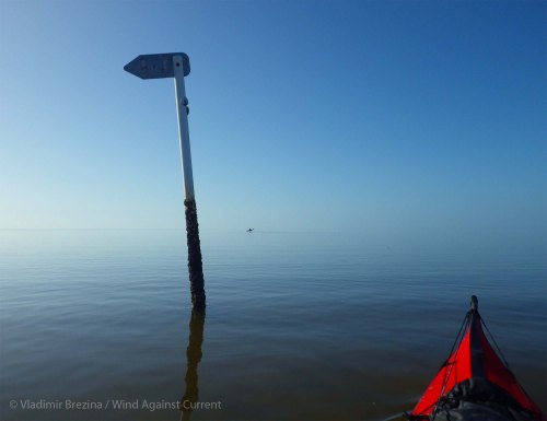


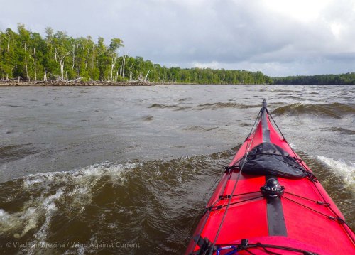


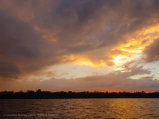


For some reason, the shot you called ‘The front overtakes us’ I find quite mesmerising. The detail of the water’s surface is magnificent. However! – your stories of the mosquitoes and midges and whatever had me shuddering. You two are made of stern stuff!
LikeLike
I love that photo, too, MR. It really felt like that—one minute it was warm and sunny, then the cold dark overtook us…..
Funny you should mention the bugs… last night we were debating whether the bugs ware “pretty bad”, “very bad”, or “not so bad”. Vlad was maintaining that they ware “not so bad” since after we figured out the paddle jacket trick they dropped to a minor annoyance. I didn’t quite agree, so we agreed to disagree….
BTW thanks so much for your whimsical post! Loved the slideshow!
LikeLike
:-)
LikeLike
Pingback: Everglades Shakedown, Day 2: Barking Vultures, Beaches, and Bugs | Wind Against Current
Pingback: Shakedown Kayak Expedition Through the Florida Everglades: Overview | Wind Against Current
What a fabulous adventure! Sharks, storms, plagues of bugs….all on Christmas Eve!
LikeLike
Just wait for Christmas Day! ;-)
LikeLike
So many different views of the sea on one trip. She is certainly ever-changing.
LikeLike
That’s why we keep going out… :-)
LikeLike
Can’t say I blame you – She is a beauty.
LikeLike
Brave! and then Bravo! Well done.
LikeLike
Thanks!! :-)
LikeLike
what a treat to watch your adventure…and to be doing something you both enjoy so much!
LikeLike
And then it’s fun to write about and look at the photos again afterward! :-)
LikeLike
Remarkable adventure, exquisite photos. I would think paddling on Barnegat Bay at night would be worrisome…but in the back rivulets of the Everglades? With charts that don’t show campgrounds very well! Whooo! GPS at least? M :-)
LikeLike
Yes, GPS was very helpful at night among the mangroves. And with a GPS, it’s almost easier to navigate in a place where there are lots of islands around, even if they are all pretty much identical, than it often is in completely open water, because you have to make only short-range decisions that immediately correct themselves when they are wrong…
Thanks!!
LikeLike
Glad to see it looks like you’re enjoying yourselves.
LikeLike
Indeed we are! Thanks!!
LikeLike
Fantastic!!! Thank you so much for sharing your incredible adventure!
LikeLike
You are most welcome, Amy—more to come!! :-)
LikeLike
What an intrepid couple you are! Your pics are amazing. What breathtaking skies you saw on your trip. :)
LikeLike
Tropical sunrises and sunsets, especially, can’t be beat! Unstable weather does come with its compensations… ;-)
LikeLiked by 1 person
Pingback: Everglades Shakedown, Day 4: Portage, Paddling in the Pitch Dark, and Fending Off Furious Crows | Wind Against Current
Just stunning. love your photos and I love the calmness of the water ;)
LikeLike
It was calm as never before—until the front came upon us :-)
LikeLike
Pingback: Everglades Challenge, Segment 5: Highland Beach to Flamingo | Wind Against Current
Pingback: Travel Theme: Freedom | Wind Against Current
I keep planning to hire a kayak at a local lake. I love the idea of sliding through the still waters early in the morning as the sun is rising. These photos remind me to actually make some real plans. Beautiful shots! You can keep the biting creatures to yourself though! We have enough of those here. :)
LikeLike
Unfortunately, it’s very hard to keep the biting creatures to oneself, or, much more importantly, away from oneself… they do what they will ;-)
Still waters are indeed idyllic… of course, in our experience they don’t usually stay still for long—
LikeLiked by 1 person
Pingback: Our 2015 Calendar | Wind Against Current
Pingback: Forces of Nature, Take Two | Wind Against Current
What an exciting paddle! A fun read, especially since I can’t imagine getting lost in the mangroves! I’ve only been boating in Florida once, and it was not kayaking, and someone else was navigating. Speaking of showing off your navigating…What program did you use to make a map overview picture?
LikeLike
Sorry for the late reply, kayakyrstin!
As far as navigating in the Florida mangroves goes, fortunately the principal waterways haven’t changed much over the years—although new mangrove islands have appeared here and there, and the charts must be taken with a grain of salt. A mapping GPS can be very helpful, especially at night…
The overview map is just a Google Maps image on which I then manually drew our approximate route in CorelDraw. Very low tech. More recently, I’ve been leaving the GPS on throughout the trip and then exporting our track into Google Earth. Other paddlers have still more elegant solutions, I notice, that I haven’t yet tried out.
LikeLiked by 1 person
Low tech is perfect for me! Thanks for the info :) We have a phone app gps so leaving it on would probably drain the whole battery. We haven’t done something so complex that’s been needed but the maps part would be fun of course :) we’ll probably upgrade gps at some point but for now drawing on Google maps will be good bough for the blog at least :)
LikeLiked by 1 person