By Johna Till Johnson
Photos by Vladimir Brezina
← Previous in Everglades ChallengeNext in Everglades Challenge →
.

Start: Checkpoint 1, Cape Haze Marina, Englewood, Sunday, March 2, about noon.
Finish: Magic Key, Estero Bay, Monday, March 3, about 9 AM.
Distance: 45 nautical miles (52 land miles).
Paddling time: 19.5 hours.
Rest time: 1.5 hours.
Average paddling speed: 2.3 knots.

Segment 2
I opened my eyes. Golden sunlight was flooding through the tent. It must already be mid-morning!
Last night came back to me in bits and pieces: Picking myself up out of the water, to the amusement of fellow WaterTribers. Locating the orange check-in box, and signing in our official arrival time: 2:10 AM.
Hauling my boat up the narrow path from the beach to the grassy camping area. Vlad paddling his boat—which we decided was just too heavily loaded to be moved up the path without damage—around to tie up at a dock in the marina (with permission from the race organizers).
Setting up the tent as quietly as possible amidst the snoring of our fellow campers, whose tents and bivy sacks dotted the camping area.
And yes! The bliss of a hot, warming shower. The marina had graciously made its facilities available to a bunch of cold, wet, muddy WaterTribers. (Looking down at my muddy footprints that, despite my best efforts, marred their shiny tile floors, I’d wondered if they regretted that decision.)
I looked at my watch. It was 9 AM. Near as I could calculate, I’d had about 5 hours of sleep. Time to get moving!
But it was hard to motivate myself in the warm sunshine. Most of the other campers had long since left. Only a few tents were still up, and from one or two of them came faint snoring. (At the same time, a few folks were still arriving—the cutoff time at Checkpoint 1 wasn’t until noon.)
Moving in a slight daze, I pulled on clothing and prepared breakfast. Hot coffee never tasted so sublime!
And that wasn’t the only warm nourishment. The race organizers had prepared an awards feast for the finishers of the Ultra Marathon, the concurrent one-day race that ended at Checkpoint 1. But most of them had already finished and gone home, and there was plenty of leftover food. So Vlad and I settled in with heaping plates of hot dogs, beans, potato salad, and coleslaw. Breakfast of champions!
“Hi Johna! Would you like a granola bar?” I looked up. I vaguely remembered meeting the young woman with intense blue eyes back at Fort De Soto. There weren’t that many solo female paddlers. But what was her name? “It’s Kirsten,” she said with a smile. “That is, Katamount is my tribe name.” When I apologized for not remembering her name, when she’d remembered mine, she pointed out that my name was written on the back of my PFD. D’oh!
She settled down in the grass and joined us for a chat. She’d arrived at Checkpoint 1 just before we did—-she’d been one of the shadowy moving figures on the beach, though I didn’t remember her.
After breakfast, Vlad headed off to pack his boat, which was still tied up at the dock. But Kirsten and I visited for a while longer, continuing to chat as we slowly broke camp and set up our boats, swapping “girl tips” (female paddlers have a few challenges that male ones don’t, suffice it to say). I was impressed by her spirit and grit: She was from Vermont, and no stranger to expedition paddling, but a solo Everglades Challenge was pretty intimidating. I would end up even more impressed by her at the end of the challenge—and I wouldn’t be the only one.
Kirsten wasn’t the only person we met at the camp. A lean, cheerful fellow named Mike (tribal name: IncipitFugitHora) had been paddling another Nordkapp—a yellow one with a yellow sail—in the Ultra Marathon. I remembered chatting with him late the previous night before we’d fallen asleep. He was scoping out the rest of the course, for future competition. We’d see him again, along with his friend Patrick (FalconSail), who’d arrived at Checkpoint 1 a few hours before us. And we learned that the sailing father-and-son-in-law team (SirTackAlot and WindWatcher) had arrived a good 12 hours ago, thanks to the helpful tailwind of the day before.
We didn’t learn until later that Driftwood had come and gone, arriving at Checkpoint 1 in just under 13 hours. Just as we were departing Snake Island, in other words, he was pulling into Checkpoint 1—so much for that “itty, bitty” sail!
Between breakfasting, visiting, and breaking camp, we didn’t get moving until noon. It seemed strange to be launching as the sun was beginning its slow slide down the sky—but then, we had an entire night to paddle through in front of us!
That morning, Vlad and I decided to go for broke. The next stretch of the Challenge passed through some heavily populated areas, and we didn’t know of too many campsites along the way. So we decided to head for Magic Key, a tiny mangrove island in Estero Bay, just south of Fort Myers.
We’d camped there on our shakedown trip in April 2013. We’d discovered it purely by accident, in the last fading rays of sunset, and remembered it as delightful. It had a high interior ridge of crushed oyster shells—just big enough to pitch the tent, and high enough to keep it dry at high tide—with a ring of mangroves around it thick enough for privacy, but not so thick as to trap bugs, or keep the fresh breezes from blowing through. Perfect!
It would be a long haul—another 45 nautical miles—but if we made it, we’d be a third of the way through the Everglades Challenge. If we kept going at this pace, I calculated gleefully, we might even make it to Key Largo by Friday night—in time to enjoy the barbecue feast on Saturday!
Of course, there was the cold front scheduled to come through on Wednesday. We’d need to make it to the protected “inside” route through the Everglades before then. But as we paddled along in the bright noon sunshine, that didn’t seem like a problem…

Today, we paddle on the “inside”… But what’s this??
We continued down the Intracoastal Waterway. It was delightful, calm and sunny, with just a hint of a cool breeze. Water flashed beneath our paddles, and… what was that? A brown-and-white spotted Aplysia swam by, its “wings” flapping softly. A Sea Hare! Vlad’s totem creature—another good omen.

It’s a swimming sea hare

Ospreys have pretty much taken over
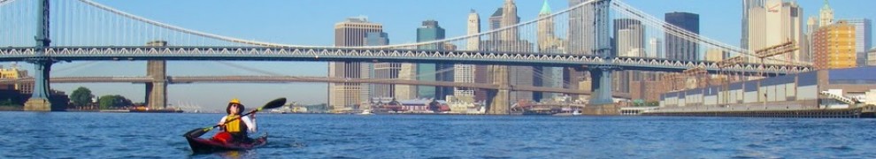
We saw plenty of other creatures too, the usual assortment: Pelicans, ospreys, dolphins. And, in this stretch of the waterway, many other people, on boats and on land. We paddled under the bridge at Placida, where people were fishing off the old bridge.
The current stayed with us into Gasparilla Sound, where we found we had to strictly keep to the edge of the channel of the Intracoastal Waterway to avoid both the shallow water on either side and the procession of powerboats down the waterway itself. Around mid-afternoon, we decided to stop for an on-water “lunch”. We pulled away from the channel to eat—but the wind kept blowing us back into the channel. We finally ended up paddling for five minutes, eating for two, paddling back out for five minutes…

We are not alone in the Intracoastal Waterway
By late afternoon, we’d crossed the expanse of Charlotte Harbor, keeping Boca Grande, its exit out to the open Gulf, off to our right. As the sun got lower, we made sure we were wearing enough clothing—we didn’t want to repeat the previous night’s mistake.

We follow the markers down Pine Island Sound at dusk
Sunset filled the sky with a golden glow. In the fading light, we followed the markers of the Intracoastal Waterway south down Pine Island Sound. Our interim destination: North Captiva Island, where we’d also camped on our trip in April. We figured we’d stop there and eat a full warm dinner with coffee. That would keep us nourished and warm enough to paddle on through the night.
But the beach was about a mile to our right, off the Intracoastal Waterway, and, as we’d discovered in April, it was protected by formidable shallows, at low tide hard to traverse even in a kayak. Fortunately, the chart showed an unmarked twisting channel through them leading to the beach. It was now fully dark; we followed the twists and turns of the channel by GPS. And we pulled onto the beach at North Captiva. Everything was proceeding according to plan!
Not quite. We hadn’t counted on the fierce population of mosquitoes. This was the first time they were bad on this trip—but it wouldn’t be the last. We pulled on bug nets and sprayed ourselves with DEET, then set about preparing dinner. But it’s hard to eat with a bug net on; we ended up gulping our food and coffee—with unpleasant results (at least for me) later on.

We stop for dinner on North Captiva Island
As soon as we’d eaten, we hurriedly launched again. We had the follow the unmarked channel back out to the Intracoastal Waterway. But I was feeling antsy, and resisted Vlad’s urging to follow the channel on the GPS, which seemed to be taking us in the wrong direction.
There were no markers. And there seemed to be open water ahead of us. Why not make a beeline in the direction we wanted to go? (This would not be the first time we had a debate about whether to set our course by the GPS, or by what we could see.) Grumbling something about “shoals”, Vlad reluctantly followed me…
…until I ran aground on one. Vlad was right: The only safe route was backtracking down the channel, following it on the GPS.
So that’s what we did.
Finally, after a half hour or so, we were back on the Intracoastal Waterway, heading south once more. We had our headlamps on, and followed the waterway’s reflective markers, which were visible from quite a distance.
But something was strange. The night was cloudy, and lights from the mainland to our left streaked the sky with pale orange stripes that made a sort of pattern overhead.
I couldn’t shake the feeling that I was paddling right underneath the George Washington Bridge, somehow transported a thousand miles south and blown up to ten times its natural size. No matter how hard I convinced myself it was just a pattern in the sky, I could “feel” it above me.
I didn’t realize it then, but that was the start of the hallucinations we’d both end up experiencing on and off throughout the trip. It’s a known phenomenon for distance kayakers: The combination of sleep deprivation and sensory deprivation creates realistic, and highly unnerving, hallucinations. You’re not going insane—your rational mind knows perfectly well that what you “see” isn’t really there–but it’s hard not to see it.
It grew darker. I saw a flock of ducks paddling among the waves. I blinked, and they were gone. Then they reappeared—but as flat pop-ups, like hunting targets.
Vlad laughed when I mentioned them to him. “Pop-up ducks! That’s pretty funny.” But then he grew thoughtful. “You know, I keep seeing trees…”
We kept paddling, keeping the long, dark shadow of Sanibel Island to our right. It seemed to go on forever. And I was beginning to feel ill. Some combination of dehydration, lack of sleep, our hastily-consumed dinner, or some other factor was making itself known in my guts. “We can stop on the causeway,” Vlad said. “They have bathrooms there.” I vaguely remembered them from our previous trip—nice, clean, fancy bathrooms. And picnic tables. Maybe even a place to camp?
Because, despite our brave plans, I was beginning to get sleepy. The lights were blurring around me. And the tide was against us, so we weren’t making much progress…
It seemed to last forever, that paddle through the early part of the night. The Sanibel Causeway loomed in front of us, never seeming to get any closer. The harder we paddled, the farther away it appeared.
After an interminable time, Vlad said, “Only about another mile now.” We kept paddling. And paddling. And paddling.
It seemed as though hours more went by before the beach appeared ahead of us, and our paddles struck sandy bottom.
My stomach gave a lurch, and I realized I wasn’t going to be locating any bathrooms, which (if they were even open) were across the road above. So I pulled the boat on to the beach and went to search out a bit of privacy.
No such luck! Although the beach was dark and quiet, I noticed green flashes as I splashed through the water. Bioluminescence! This is a fascinating phenomenon in which light-emitting microorganisms cause the water to literally glow, particularly in response to motion.
I’d heard of it, but never seen it—and always wanted to. And now the one time I wanted darkness and peace, the water around me was glowing green, lighting up everything in sight.
Oh well. You take what you get, sometimes!
Feeling much better—and enjoying the dancing green waves, no matter how inconvenient—I splashed back to the boat. Vlad had a bite to eat, and we paddled on.
For some reason, as soon as we passed under the causeway and entered Big Carlos Bay, I became disoriented. It was the only time during the trip where I totally lost my sense of direction (something that briefly happened to Vlad as well later at Marco Island). So I just followed Vlad as we made our way across the waves, looking at the lights glittering here and there around the bay.
Our plan was to head to the mouth of Matanzas Pass to see if we could take the inside route behind Estero Island. If so, it was the fastest, most direct route to Magic Key. But if the current through the pass was against us, we’d be better off paddling along the outside of Estero Island and then in through the next pass, Big Carlos Pass. This would mean paddling a couple of miles farther tonight, and again in the morning. But we wouldn’t be fighting the tide.
And that’s what happened. The current was indeed against us at Matanzas Pass, and so we headed down the Gulf. Along the shoreline to our left streamed an endless line of illuminated hotels and condos, which I remembered from our last trip. To our right, the open sea. And overhead, the stars had finally come out. I noticed one in particular, a bright one low in the sky. Or maybe it was a planet. I’m not sure which. But I found that by keeping my bow aligned with it, I could keep my course constant.
“I’m navigating by starlight,” I told Vlad, who snorted. “If you really want to do that, you’ll have to be able to figure out where we are by the position of the stars. In the meantime, fortunately, we have the GPS.” Oh well—but at least my course was straight.
We paddled on through the night. After my earlier sleepiness, I found I was wide awake and energized, a pattern that held pretty consistently: I’d get sleepy around 1 AM, then get a second wind around 3 or 4 AM. The hallucinations had receded. Every so often we’d stop and have mint cakes and coffee. (For the next few days, mint cakes were pretty much the only thing that wouldn’t unsettle my stomach.)
We kept paddling. I’d had some vague hopes of making it to Magic Key by sunrise, but as the sky grew lighter, it became clear that wasn’t going to happen. Finally dawn broke—the first of many we’d see during the trip.

Dawn… we are still paddling

Into the sunrise
The beach to our left sparkled pristine and pinkish-white, washed by the rays of the early-morning sun. We paddled. And paddled. And paddled some more.
Up ahead was Big Carlos Pass. Surely it wouldn’t be long now?
Alas, the tide was against us yet again. Slowly, slowly, we crept up to the mouth of the pass… only to confront a strong ebb current.
Ugh.
Vlad was able to make decent headway, but I fell farther and farther behind, even staying as close as possible to the shore, where the current was weaker.
I’d turned my GPS off, but I could tell I was going well under 2 knots, maybe even under 1 knot. I’d be faster off walking…
The thought was the deed.
I jumped out of my boat, grabbed my bow line, and started walking, towing the boat behind me. Vlad laughed when he saw me. “You just don’t give up, do you?” he said. “Nope,” I replied.
And another good omen: Just as I passed under the bridge spanning the narrowest part of the pass, I saw a live starfish, gently curling its arms in the current. And another. And another. So charmed that I forgot my tiredness, I kept walking, carefully avoiding the starfish, as the morning sunlight sparkled around me.

Dawn hunt among the highrises

Landed on Magic Key
Beyond the bridge, I was able to climb back into my boat. We made our way through the mangrove islands of Estero Bay, trying to determine which one was Magic Key. Fortunately, Vlad remembered. Exhausted, yet triumphant, we paddled up and disembarked.

Magic Key: just big enough for one tent
It was full morning by the time we made camp, and we took our time. We changed into dry clothes and hung our wetsuits up to dry. Vlad had a snack. I scrubbed up. We didn’t need bug gear, as the breeze kept the bugs away. So we settled into the tent and happily closed our eyes in the morning warmth.

We rest for a few precious hours…
_______________________________________________________
Photos from Segment 2 (click on any photo to start slideshow):


More photos (from all segments) are here.
Next in Everglades Challenge →


Pingback: Everglades Challenge, Segment 1: Fort De Soto to Cape Haze | Wind Against Current
Pingback: Everglades Challenge, Overview | Wind Against Current
What an incredible marathon, I can’t imagine stretching myself so far. Thanks for sharing the story, is fascinating to read, look forward to next installments.
LikeLike
Oh wonderful! So glad you are enjoying it… more to come!
LikeLike
Wow! I truly admire your grit, strength and determination paddling straight through the night. The hallucinations would have really sent me for a loop.
LikeLike
And they haven’t really even started yet… wait until installment 3!
LikeLike
You’re my hero. I am going to remember you the next time I think I am having a cardiac arrest cycling up a mountain. Inspirational…or possibly crazy depending on how you look at it. :)
LikeLike
I was about to say that, fortunately, on the sea we don’t have to climb any mountains—we take it nice and easy on a (more or less) flat surface. But one of the most persistent hallucinations I had in the Everglades Challenge was that I was continually paddling uphill… Only rarely was it downhill ;-)
LikeLike
Now there is a horrific hallucination. Next thing you know a shark will jump in your boat…oh wait that was real. :)
LikeLike
Some hallucinations are just a bit more real than others :-)
LikeLike
Johna, Thanks for these accounts of the first two legs of your paddle. I followed you guys fairly closely in real time and used Google Earth to visually track your progress. Your accounts make sense of some of the curious routs I watched you follow. Your track “up” to Magic Key was a bit confounding. You located the only dry spot in the vicinity. I couldn’t figure out where you were going as I watched. The Spot made it fun from here. Ah! yes the hallucinations! Great stuff.
George
LikeLike
Yes, the detour up to Magic Key was a bit of an indulgence. It’s true that Magic Key is probably the only dry spot in that part of Estero Bay. But along the outside there are plenty of beaches there. At Big Carlos Pass, through which we came, there is Lovers Key, a park where camping is even permitted, I believe (although subject to the usual annoying restrictions). And further south of that, there are other parks along the coast. Many WaterTribers camp on the outer beach in that stretch of coast. If we’d been racing rather than cruising, we would have done the same. But we wanted to see Magic Key again, one of our favorite spots! :-)
LikeLike
You did it the right way! What a treat to get to share from sub zero temps in Maine.
George
LikeLike
It’s a mystical, magical journey, and I loved every mile of it.
LikeLike
Thanks so much! We have 200 miles more to go :-)
LikeLike
I love the sea hare…so beautiful. You really have some adventures…
LikeLike
I know, isn’t crazy? The ‘sea hare” is actually a sea SLUG… which sounds so ugly. But these creatures are as pretty as underwater angels…..
LikeLike
Wow — second leg appears before I get a chance to comment on the first! Keep ’em coming. This beats “Two Years Before the Mast.”
LikeLike
I had to look up the reference… I’m flattered! There are no icebergs in THIS account, though. But I’m glad you like it!!
As for the pacing of posting these… The issue is that I’m in the critical path. Vlad has the photos all processed and ready to go, but I need to sit down and write them. Then, once I start writing, I can usually hammer out more than one. He does a round of editing, then it’s back to me.
But basically, I’m the holdup :-) So I have to write in batches to keep Vlad happy…
LikeLike
You bet I like it! Sea hares over bergy bits any time. FWIW Richard Henry Dana had a spell of chumming. Poor devil ran on empty a few days, no mint cakes to fall back on.
LikeLike
Mint cakes would have made all the difference… and, closer to home, I bet Howard Blackburn would have appreciated some too.
LikeLike
Great pics and vivid description, looks like being part of the journey.
‘dod’ Rangers
LikeLike
Thanks! Not as many pictures as usual, due to it being a race. But glad you liked them.. some of my favorite shots are coming up in Segment 3!
LikeLike
Reblogged this on Locating Frankenstein's Brain and commented:
Good stuff so far.
LikeLike
Thanks!!
LikeLike
The Sea Hare is such a strange-looking creature. Wonderful photos. I am in awe of your stamina.
LikeLike
They look a bit more ordinary, the way you might expect a slug to look, when they are not swimming…
The stamina declined in subsequent days, sadly ;-)
LikeLike
Wow!!
LikeLike
:-)
LikeLike
What an incredible journey so far! :-)
LikeLike
And it gets better! :-)
LikeLike
What a great journey! It’s a real treat to follow it through your blog, thanks for sharing.
LikeLike
You are most welcome! More to come!!
LikeLike
Did you notice the mangrove roots at Magic Key and the tent interior have a very similar look? :-) How amazing the Sea Hare photo is, and you got to see bio luminescence – wow…It sounds like this was a very challenging trip, but worth every difficult moment.
LikeLike
Didn’t notice the similarity, actually—thanks for pointing it out!
And yes, worth every moment. Notice I didn’t say “every difficult moment”. The difficulties recede in memory each passing day… :-)
LikeLike
Pingback: Everglades Challenge, Segment 3: Magic Key to Indian Key | Wind Against Current
Pingback: Everglades Challenge, Segment 6: Flamingo to Key Largo | Wind Against Current
Pingback: Weekly Photo Challenge: Containers | Wind Against Current
Pingback: Hats | Wind Against Current
Pingback: Sea Hare | Wind Against Current
Pingback: Circumnavigating Sanibel Island, Florida | Wind Against Current