By Johna Till Johnson
Photos by Vladimir Brezina
← Previous in Everglades ChallengeNext in Everglades Challenge →
.

Start: Magic Key, Estero Bay, Monday, March 3, about 4 PM.
Finish: Indian Key, Ten Thousand Islands, Tuesday, March 4, about 10 PM.
Distance: 52 nautical miles (60 land miles).
Paddling time: 24 hours.
Rest time: 6 hours.
Average paddling speed: 2.2 knots.

Segment 3

Goodbye to Magic Key
It was well into the afternoon, about 4 PM, by the time we left Magic Key, feeling refreshed and re-invigorated. We retraced our morning route between the mangrove islands of Estero Bay, and out through Big Carlos Pass.
Halleluia! For once, the current through the pass was with us. We rode out into the Gulf on gently surging water.

We exit through Big Carlos Pass and paddle down the Gulf
The plan was simple: Paddle south along the coast until we reached Indian Key, in the heart of the Ten Thousand Islands. There we would await favorable current to ride up through Indian Key Pass to Checkpoint 2 at Chokoloskee. We needed to get to Indian Key no later than early tomorrow night, in order to be sure to make it to Chokoloskee before the cutoff time, which was 10 AM the following morning.
It would be a long, straight shot until Marco Island, about 30 miles away. Then we’d face a decision: Go “inside” through the Big Marco River? Or “outside”, around Cape Romano? The answer would depend on conditions, particularly the wind and the currents at the time. But we wouldn’t need to worry about that until the morning, at least. For now, it was time to paddle onward into the night.
There was little wind, and the water was calm. Little waves lapped against our hulls as we paddled. Nothing but the occasional cry of a gull disturbed the quiet.

The view out to sea
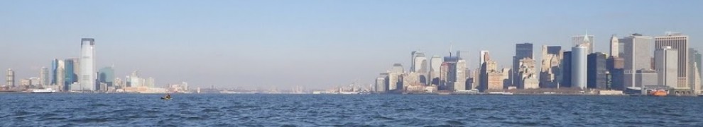
The coastline vista to our left was more of the day before: Stretches of empty beach and mangroves, marking various state parks, alternated with blocks of hotels and condos. The glass-and-cement faces of the buildings, illuminated by the late-afternoon sun, had a sort of spare beauty.

Reflections
Slowly, the afternoon faded into evening. Remembering the first evening, we put on jackets. The sun set in an orange glow, and we paddled on in the purple twilight.
.
.

We paddle on into the night
We stayed close to shore—close enough to watch the white strip of beach wind along in the light of our headlamps, but not so close as to run aground on any unexpected shoals or sandbars.
The buildings to our left gave way to darkness—nothing but mangroves. The stars twinkled brightly overhead.
To my right, I caught a glimpse of gray tree trunks. More and more of them, a tangled forest. The leaves were lost in darkness, but the smooth gray trunks and branches were clear. It was an Old English forest in winter. The trees rose westward, up the hill…
Wait a second.
West was the Gulf of Mexico! There was only water there—no forest or hills!
I blinked and stared hard. The tree trunks dissolved into misty gray stripes and I could see, once more, gently rippling dark water.
But as soon as I turned away, the forest reappeared, so vivid it was uncanny. We were paddling down a river, with forest on both sides. We were a bit closer to the right-hand shore, with the “Old English” forest rising out of the water. To the left was the (real) mangrove forest, with the strip of beach at its foot.
I stopped and had a bite of mint cake, and a few swallows of water. The forest retreated for a few minutes. But then it returned, full force.
“Umm, Vlad?” I said, hesitantly. “I think I’m hallucinating.”
“Me, too,” he replied. “I’m seeing a forest, over there, to our right. With grey tree trunks and branches. And a hill, heading up.”
Whoa. We were seeing the same exact thing? How could that be?
We discussed it, and our best guess is this: Hallucinations are caused by pattern-matching in the brain. You pick up visual stimuli, and your brain tries to interpret them as some kind of familiar image. And even if there are few visual stimuli—we saw the hallucinatory objects mostly where there was just formless darkness, with no visual cues whatever—the brain does its best. Talking to other WaterTribers later, we found out that trees are common kayaker hallucinations—for obvious reasons. It’s likely that we both saw a forest such as we often encounter, for instance, on our paddles from NYC up the Hudson north of the George Washington Bridge. (Speaking of which, that was my hallucination of the day before.) So because we were exposed to the same stimuli, and had the same paddling frame of reference, we were seeing the same thing.
We gave up trying to convince ourselves the forest wasn’t there, or that we weren’t in a river. And in talking to each other, we found ourselves using the hallucinations as a point of reference:
“Is that a dolphin?”
“Where?”
“About ten yards in from the forest, in the middle of the river.”
“No, I think it’s just a wave.”
After a while, lights began to reappear on the (real) shoreline to our left. And unnervingly, a few lights appeared off in the “woods” to our right, up the hill. Not just lights—they seemed to be the windows of a building. Or buildings. We could just barely make out the shapes of the buildings among the trees. Er, “trees”.
“There’s a house over in the woods. Up the hill.”
“Yes, I see it.”
“Umm… wait, is it real?”
Hard to tell. The lights flickered and twinkled, the trees momentarily blocking our vision as we paddled past. But as we drew closer, the lights continued to persist, and they looked more and more like the windows of buildings. Were they real? Or hallucinations?
Suddenly there appeared in front of us a series of pilings. We blinked a few times, and made out a long pier, extending out into the Gulf. It was the Naples Pier. And the “houses” were real: Pavilions on the pier. They appeared to be “up a hill” because they were up high—on the pier above us.
We went under the pier, and the forest closed in around us again. We kept paddling down the river, watching the stars sparkling among the trees in the forest.
Approaching Gordon Pass, the chart showed that we needed to paddle far out to avoid the shoals at the mouth of the pass. We had to paddle toward the flashing red light of a buoy far to our right—directly into the forest.
It was surreal. The grey tree trunks rose directly in front of us, inches from our bows. I’d paddle forward, and the trees would dissolve into mist—but with more trees behind them. So I was paddling into a forest that was retreating from me, very slowly, but seemed to be all around me. Moreover, the forest appeared to be slanting upward, so that we were continually paddling up, with an increasingly steep drop-off to our left, at the edge of the forest.
Finally we passed the flashing red light. We turned left and continued south down the river, hallucinatory forest still to our right. The lights to the left had disappeared; we’d reached Keewaydin Island.
Everything was dark and quiet; the only motion was the occasional silvery flash of a fish, caught in the spotlight of my headlamp, in the water alongside me. Suddenly I saw something shiny, but longer than a normal fish, slide under the boat.
Was that a shark? Indeed. And another one crossed over in the opposite direction.
Sharks were criss-crossing underneath my boat.
For whatever reason, I didn’t doubt for a moment that these were real. And I wasn’t unduly worried: They were fairly small, and likely to be intimidated by the size of our kayaks. But I was glad I wouldn’t need to get out of the boat for a while. And I couldn’t shake the memory of one WaterTriber’s photos posted a few weeks back: A kayak hull with the imprint of a 12-inch shark bite in it.
We paddled on, into the darkness, down the river, with no sound but the splish-splash of our paddles and the gentle lapping of the waves.
Wait, was that a headlamp? We looked to our left, towards the (real) shore: Indeed it was. Some sort of a sailboat was perched on shore, and someone was moving around it, headlamp shining brightly in the darkness. We weren’t close enough to tell, but we guessed it was a WaterTriber—a reasonable guess, as it turned out.
Sometime around 5 AM we arrived at Marco Island. We knew we’d arrived based on the GPS; plus there were lights all around us.
Except… that was the problem. According to the charts, both the physical charts and the GPS, there shouldn’t have been lights all around us—most of the land should have been undeveloped mangroves. But obviously things had changed since the charts were last updated—a situation we’d run across before.
We were at a kind of a cross-roads, with many possible ways to go. We started searching for numbered markers. It was Vlad’s turn to get disoriented. Eventually I pointed out what turned out to be the right channel, and we were soon headed toward Big Marco River.
Some kind of sailing vessel approached us in the darkness. “Hey, are you guys WaterTribers?” they asked. We said we were, and exchanged greetings. They headed out to the Gulf. And we kept paddling toward Big Marco River.
It became clear pretty quickly that we were out of luck. The current was ebbing—against us—and our best guess was that would continue for several hours. What to do? We could try to find a campsite and sleep a few hours until the current changed, or give up on Big Marco River and take the outside route.
The outside route it was. We turned around and paddled back out towards the Gulf.

At dawn, off Marco Island…

… we are still paddling
Slowly the darkness dissipated, and dawn broke, illuminating the white sandy beaches all around with pink and gold. We passed another WaterTriber resting on the beach. He said he was waiting for the current in the Big Marco River to change. We agreed that was a good strategy (even though we weren’t taking it ourselves) and continued on.

Past the highrises at sunrise
As the sun rose higher, we paddled past white beaches and rows of highrise condos. We passed a point, and suddenly were at the end of Marco Island.
Our plan had been to keep going, around the outside of Cape Romano. But I was running out of gas—I’d had about eight hours of sleep in the past three days, and still hadn’t really recovered from my bout with indigestion the night before.
And ahead of us was Dickman’s Island, an undeveloped mangrove island with an inviting-looking white sandy beach.
A brief nap on the beach
It didn’t take much discussion. We pulled up to shore, tied the boats to a tree and found a spot in the shade. I made a pillow out of my PFD, pulled my hat over my face, and pulled the spray skirt over me like a blanket.
I was asleep almost as soon as I shut my eyes.

I’ll join Johna
I woke up about two hours later, surprisingly chilly. We drank some water and Vlad had a snack. Then we launched again.
There was now a strong current in our favor through the passes leading eastward, between the keys immediately south of Marco Island. It therefore no longer made sense to paddle all the way around Cape Romano. Instead, we’d take a shortcut through the passes, pop out in the middle of Gullivan Bay, and make our way down the Ten Thousand Islands.

We paddle south through Gullivan Bay
And that’s what we did. It was another perfect day (for paddlers, at least): Sunny, but cool, with not too much wind, just enough to keep it from being boring. We kept going until mid-afternoon, when Vlad started to get sleepy. Well, we knew what to do: We pulled up to an inviting-looking key, tied up the boats, and took another nap—this time being sure to stay in the sun, so we wouldn’t wake up chilled.

We land on one of the Ten Thousand Islands
This nap was shorter than the first, and we were well on the way to Indian Key by mid-afternoon.

… then we press on

The beginning of the Everglades National Park!
As the sun declined in the sky, we came to a lonely marker in the middle of the water: The official boundary of the Everglades National Park. We’d made it there already!
We pulled up close so we could take pictures of each other at the marker. We were pretty impressed with ourselves: In our first two days, we’d gone farther than in the entire five days of our first Everglades shakedown trip in April 2013. We’d learned that we could pull all-nighters with impunity, and we’d figured out the art of napping to get a quick energy boost. We’d overcome darkness, cold, illness, disorientation, sharks, and hallucinations.
")
We made it… only slightly worse for wear (photo by Johna)
Why, we practically had this Everglades Challenge thing licked! At this rate, we’d be in Key Largo by Friday evening, easy—enjoying a soft hotel bed and that Saturday victory barbecue. Who said this thing was hard?
You know what they say about pride going before a fall. At the back of my mind, I remembered that the cold front was still on its way—and fronts are game-changers, with the wind and conditions they bring. Something else I didn’t realize—but should have—was that the cumulative lack of sleep would take its toll, too. Just because you can pull one, or several all-nighters doesn’t mean you can carry off the next one, as we’d find out to our detriment.
But all that was still in the future. For now, we were pointed towards Indian Key, as the sun slowly set. The second sunset on the water since leaving our last real campsite on Magic Key!

Another evening on the water…

High clouds catch the last rays

Again, we paddle on into the night
We reached Indian Key a couple of hours after dark. We hadn’t originally intended to camp there—in fact, Vlad vaguely remembered it was illegal. Or required a permit. Or something.*
But as we paddled around the island, we realized two things: First, nobody would stop us at this time of night. It was almost 9 PM, and there was zero indication of any other humans. Second, quite possibly the reason for this was that there didn’t seem to actually be a campsite there.**
There was a spot underneath some mangroves, at the head of a muddy, sulphurous-smelling beach strewn with oyster shells. But it was low tide, or thereabouts—the “campsite” would likely be underwater by high tide, which we calculated would arrive at 2 AM.
But we’d need to be gone by then anyway. We figured the water wouldn’t reach the campsite until about 1 AM—about the time we wanted to leave. So we went ahead and pitched camp.
As usual, Vlad put up the tent while I cooked. But afterwards, we made sure to tie everything securely down (or so we thought)—just in case the water came in faster than we were expecting. The boats were tied up to mangrove trees, with hatch-covers securely fastened. But we also made sure to attach paddles, PFDs, and spray skirts to the boats.
It felt good to crawl inside the tent. I almost couldn’t remember the last time I’d slept inside—Magic Key seemed like weeks ago. It was just about 10 PM as I shut my eyes. I fell asleep instantly.
_______________________________________________________
*After the trip, we looked it up: Indian Key was at one time one of the official campsites of the Everglades National Park, where camping was allowed with a permit. It is no longer an official campsite, and so camping there is strictly speaking not legal.
**For the benefit of anyone who may want to camp on Indian Key: To check on the current through Indian Key Pass, through which we would have to pass next, we had paddled around to the east side of Indian Key, and so were looking for campsites there. But in the pitch darkness, we completely missed the beautiful sandy beaches that line the western side of Indian Key. Google Maps revealed these right away as soon as we looked after the trip. Before the trip, we had used Google Maps to examine many potential campsites—but not Indian Key…
_______________________________________________________
Photos from Segment 3 (click on any photo to start slideshow):


")


More photos (from all segments) are here.
Next in Everglades Challenge →


Pingback: Everglades Challenge, Segment 2: Cape Haze to Magic Key | Wind Against Current
Reblogged this on Locating Frankenstein's Brain.
LikeLike
Thanks!
LikeLike
Pingback: Everglades Challenge, Overview | Wind Against Current
wow…this is like a way kewl adventure… an awesome jpourney,,, very kewl :) .. u guys are awesome .. take care …..Q
LikeLike
Thanks!
LikeLike
Stunning!
LikeLike
:-) Thank you!
LikeLike
I can’t even imagine the stamina it takes to do such a challenge. I am afraid if I laid down for a nap I would never get up again. That hallucinating would really throw me for a loop. Oh yes and sharks. You two rock!
LikeLike
Thank you! It was surreal, but not as disturbing as you might imagine. Although we’re still debating whether a string of mangrove islands that we both saw was, or was not, a hallucination.
LikeLike
You’ll need to use your camera at night and check later :)
LikeLike
Yes, there are distinct gaps in the photos from the trip where we paddled at night. Unfortunately it was very dark, or even completely dark, all around, almost everywhere, and the distances to any interesting object, even Johna paddling alongside, too great for the flash to bridge…
LikeLike
Yes no exactly great photo environments. Well perhaps it is beat left as the Mystery of the Mangroves.
LikeLike
Well, there certainly weren’t any islands on the chart there—just the open Gulf of Mexico. On the other hand, what do charts know? Magic Key, for instance, isn’t on the chart—that’s part of its magic character :-) On some of the more detailed charts, a shoal is shown where Magic Key is, but not an island, even though the mangroves on Magic Key have obviously been there for years, if not decades. And we encountered another clear case of that kind on the last day of the challenge, as we’ll describe in due course…
LikeLike
It really is a mystery. I look forward to further hallucinations… I mean posts. :)
LikeLike
Okay…a couple of things. This is a magical posting.
I have had the pleasure of joint hallucinations when in semi-cue deprived situations, and it was brilliant, especially after the fact.
Vlad commented on my blog celebrating Andra’s completion of her walk that he appreciated my calling you hard core kayakers but that I was wrong. He claims that you are not. Are you really that self-depricating? Or just still hallucinating?
I am reblogging this. A great post! A great adventure. You guys are really the cat’s pajamas.
LikeLike
Actually, I don’t think we’re that hard core. Like any expeditioneers, we play to our strengths, which in this case are endurance, persistence, and navigational expertise rather than, say, speed or power.
To my mind, “hard-core” would be someone with all of the above–which would probably result in a much higher placement in the race :-).
LikeLike
Reblogged this on The Quotidian Hudson and commented:
These folks recently told me that they don’t regard themselves as hard core kayakers. I disagree. Who do you think is correct? This is a great post, by the way.
LikeLike
Thanks for reblogging, Robert—much appreciated!
LikeLike
Reblogged this on Providing Solutions: Making life easier and commented:
Magic
LikeLike
Thanks!! :-)
LikeLike
What an awesome journey! So thrilling! It makes me dream.That is a so great adventure. Congratulations!
LikeLike
Thanks! Please do dream.. and then follow those dreams!
LikeLike
Funny thing about the hallucinations. You city dwellers see a forest. I see endless Brownstones. Ha!
LikeLike
That’s hilarious, George. Anyone sitting on the stoops of those brownstones?
LikeLike
It is true. When you related your discussion of how the brain probably constructs images from the fragments of stimulus it is receiving when it is over tired it made sense that the vertical light and shadow patterns got translated into tightly packed buildings. I was in a densely forested environment that time. Ha! I don’t remember anyone sitting on the stoops.
LikeLike
Well, I would take that theory with a grain of salt. After, all, Johna saw pop-up ducks, and I saw butterflies and a man riding a bicycle… Other WaterTribers saw even more weird and wonderful hallucinations :-)
LikeLike
Your discussion of the mirages/hallucinations is pretty amazing. At times like that, it’s good to have the scientific background and training to pull you back to earth, right? I love the shot titled “At dawn, Marco Island.”
LikeLike
Not sure our explanation is really correct, actually—will have to think about it some more.
In any case, knowing that they were hallucinations, and having some idea of how they were produced, didn’t stop them from appearing, and being more than a little distracting…
LikeLike
Nice reading about you
Thanks for visiting my blog. Be in touch. Browse through the category sections, I feel you may find something of your interest.
LikeLike
Thanks for visiting our blog! Took a look at yours—you’ve posted some lovely photos! :-)
LikeLike
Thank you so much sir :)
LikeLike
You two are amazing, not as much for this Herculean odyssey as for the conjuring of identical hallucinations at the same time. It takes togrtherness to a higher level.
LikeLike
Thanks David :-). That kind of togetherness was decidedly odd, indeed!
LikeLike
When I hear about your incredible, daring, challenging and difficult journeys along the coast of Florida I’m always so impressed. After seeing your incredible photos, I can see why you’re addicted to this strenuous adventure. I’m thrilled that I can live vicariously through you as this is one thing I’d never do. :-)
LikeLike
Glad to have you along! And we are only half-way through!! :-)
LikeLike
Love your second sunset pic over the water. Hallucinations sound very spooky. You may not call yourselves hard core but you are definitely intrepid.Look forward to the next installment.
LikeLike
Coming soon! Thanks!! :-)
LikeLike
Pingback: Everglades Challenge, Segment 4: Indian Key to Highland Beach | Wind Against Current
For me the stars at night start connecting. Sometimes it is a vine stretching across the sky. Sometimes these connections are the branches and trunks of trees reaching down to the horizon. There have been times when I’ve returned to the same spot during the daylight on subsequent EC’s, to be surprised that there are no trees there at all.
LikeLike
It was fun to read about everyone’s hallucinations :-)
As a scientist, I find two things intriguing:
(1) How similar hallucinations repeat over and over for different people—vertical things, such a tree trunks, seem to be very common… In my case, it was pretty obvious that my brain was trying to fill in spots where there was, in actuality, nothing to be seen. I started interpreting the dark gaps between real lights on the horizon as trees, or such-like, pretty early on…
(2) How significantly the hallucinations can change your perception of reality. Even though we knew the forest was not really there, it nevertheless strongly affected our intuitive perception of the scene, and even, possibly, our navigational choices. We had the strongest feeling we were in a narrow, protected river, while in reality we were on the outer coast of the Gulf of Mexico…
LikeLike
Pingback: A Tale of Two Compasses | Wind Against Current
Pingback: Weekly Photo Challenge: Endurance | Wind Against Current
Pingback: Freepaddling in the Ten Thousand Islands: Part Three | Wind Against Current