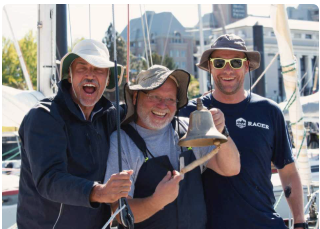
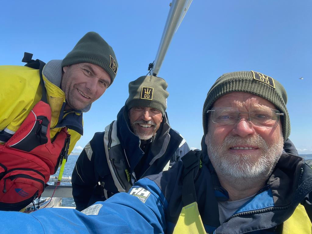
Happy Team Trimorons in Victoria!(Photo:React Photography, Kelsey Fletcher)
It was an uneventful sail.
That is, if you don’t count bright sunshine, dying winds, a fierce opposing current towards the end… and the usual odds and ends of mechanical issues and trim. One of the pedal drives needed adjustment. The “cruising” setup of the boat (a full kitchen and bathroom) added weight.
But Team Trimorons safely crossed the 40-mile open-water “proving ground”, which is what the R2AK organizers call the first leg of the race. Basically, they test the sailors’ mettle with a 40-mile open-water passage, carefully monitored by support boats.
There’s no guarantee this leg will be the roughest part of the journey–in fact, there’s almost an iron-clad guarantee that it won’t be—but safely navigating, and sailing, and pedaling across 40 miles of open water tends to separate the do-ers from the dreamers.
Team Trimorons started in the chill 5 AM dawn. (Please note the warm, waterproof DexShell caps.. soon I’ll be letting you know how to get a Trimoron logo-ed cap of your very own!)
Jeff in drysuitChris bundled up!
By midday they’d stripped down to shorts and T shirts, and exchanged the warm hats for floppy sunhats (or none at all)….
Chris the pedaling champ!
About that pedaling…
I asked Jeff if he had to pedal much, and here was his (characteristically laconic) reply:
3-4 miles. Strong tide current against us into Victoria. The water was moving past us fast, but moving over the ground at less than 2 knots.
This was the first of the fierce Pacific Northwest currents. I’m sure it won’t be the last!
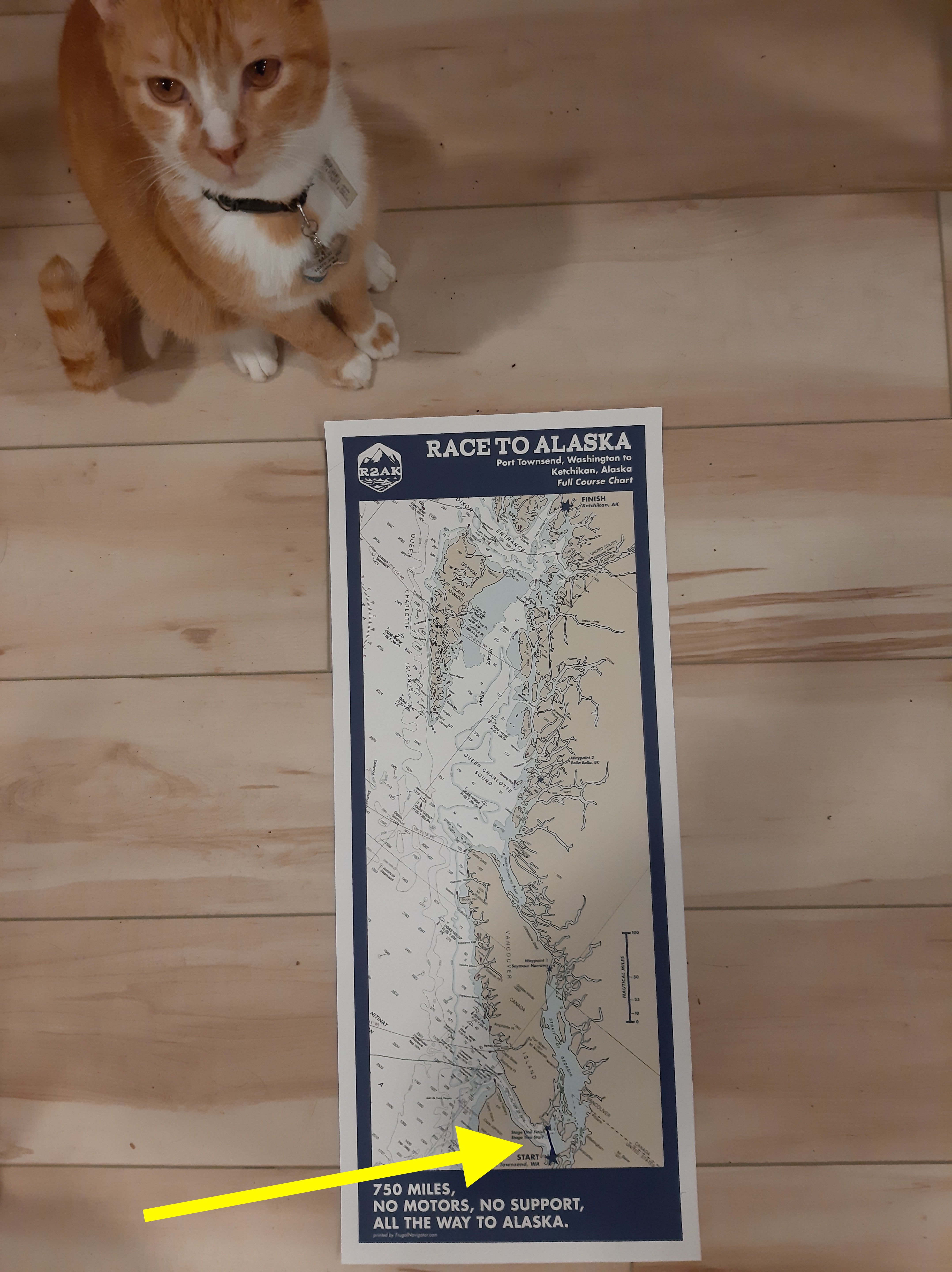
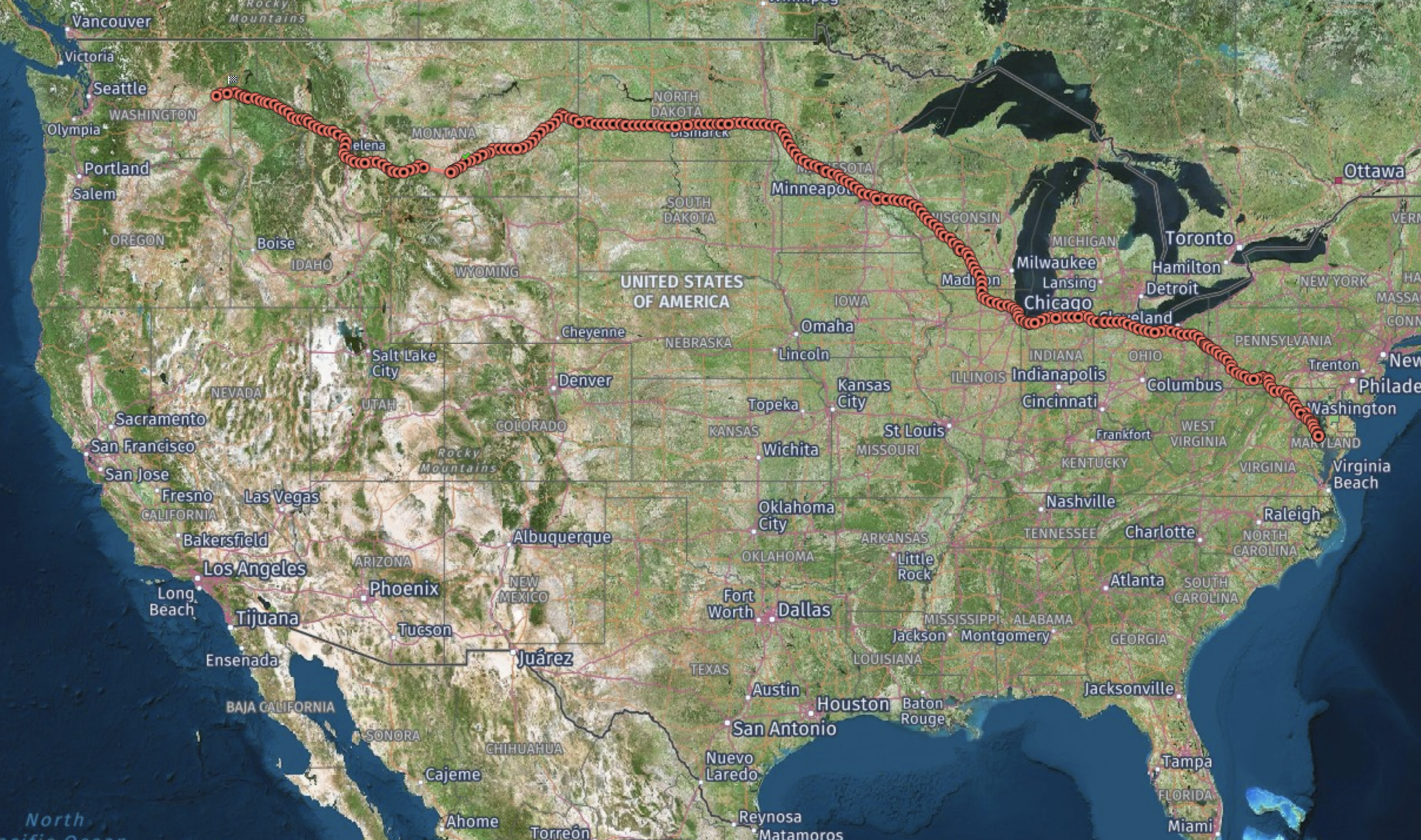
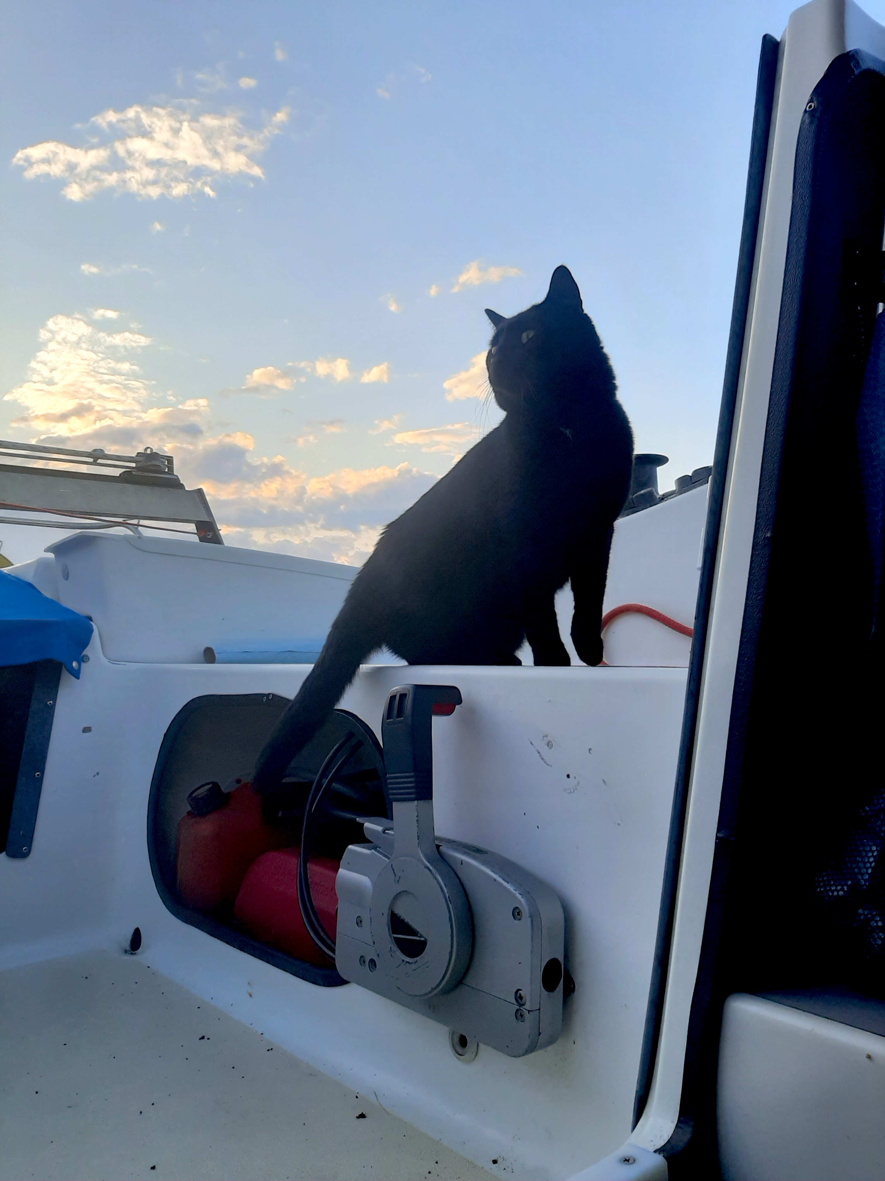
You may be thinking a 40-mile sail sounds strenuous. Heck, I think a 40-mile sail is pretty strenuous! But Maxi the cat was unimpressed. Maybe it’s because he saw what a very small portion of the race they’ve completed thus far:
Maxi is unimpressed…
That little blue line pointed to by the arrow? That’s how far they’ve come. See that star WAY up in the upper right of the chart, under the word “Alaska”? Yeah. That one. That’s where they’re going.
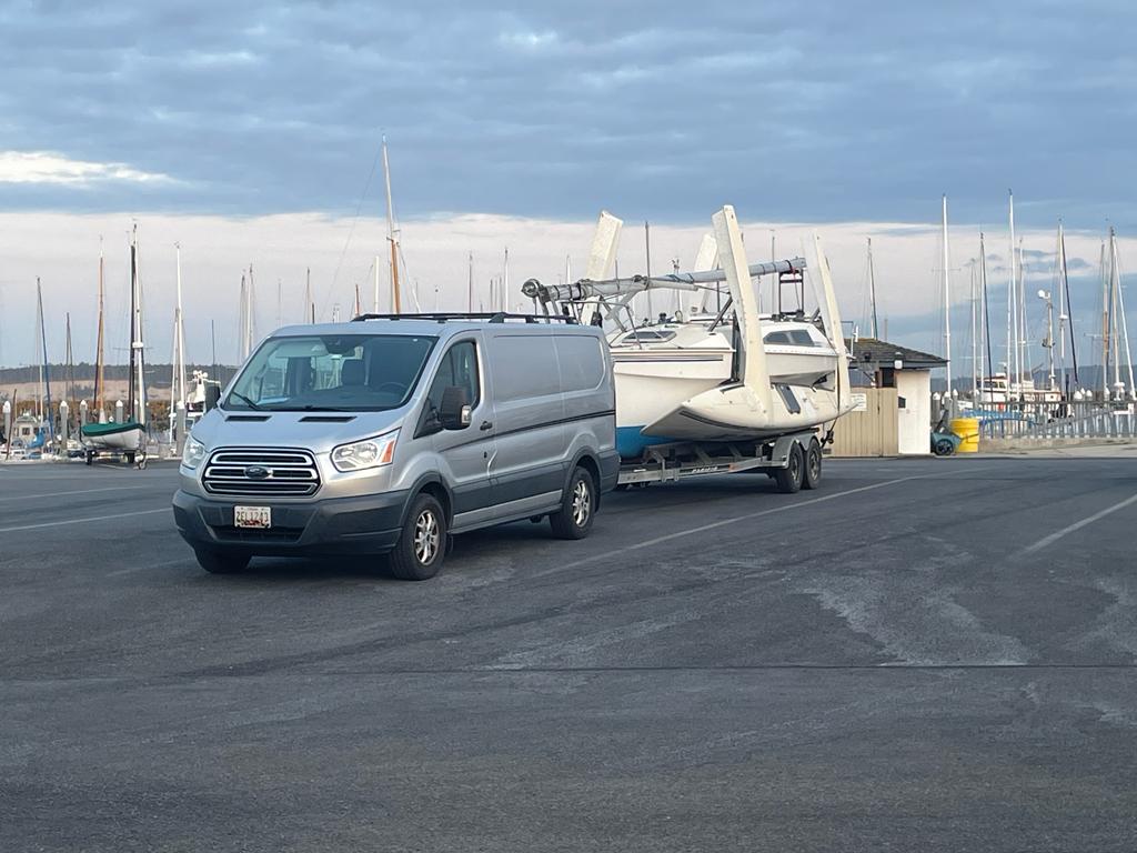
After four separate boat inspections (including the boat-sniffing dog) Team Trimorons crossed the mountains and arrived at Port Townsend. The next few days were busy doing last-minute packing and organizing, and a few other things…
Team Trimorons all together! Logo placement #1…
There was the question of attaching the logos…
Logo placement #2
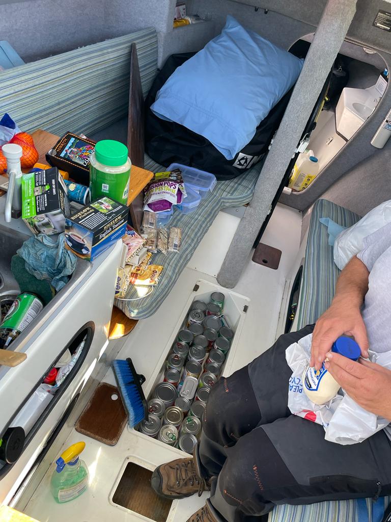
Then there was the question of organizing provisions…
Provisioning…
Chris is a neatnik, so Christina Rose is cleaner and more organized than she’s ever been in her life!
And Jeff needed a way to remember the occasion…
R2AK Forever!
Vlad can’t wait to start eating the roast meat…
Dinner!
And last but not least, a couple of shakedown cruises…
Testing the spinnaker…
And testing the genoa!
Monday, June 5 at 0500 is the big start. Team Trimorons assures me they’re rested and ready!
The Two-Thirds Trimorons slept deeply and awoke early. The plan was to be on the road around 0400; there was a slight delay as they realized they’d managed to lock the keys inside the van.
Oops.
Fortunately one of the windows was slightly cracked, and they were able to use the boat hook to retrieve them. They started on their merry way, towards the Crazy Mountains.
Apparently the name is an anglification of a Crow name; Wikipedia gives two slightly different sources:
The name Crazy Mountains is said to be a shortened form of the name “Crazy Woman Mountains” given them, in complement to their original Crow name, after a woman who went insane and lived in them after her family was killed in the westward settlement movement.
The Crow people called the mountains Awaxaawapìa Pìa, roughly translated as “Ominous Mountains”, or even more roughly, “Crazy Mountains”. They were famous to the Crow people for having metaphysical powers and being unpredictable—a place used for vision quests.
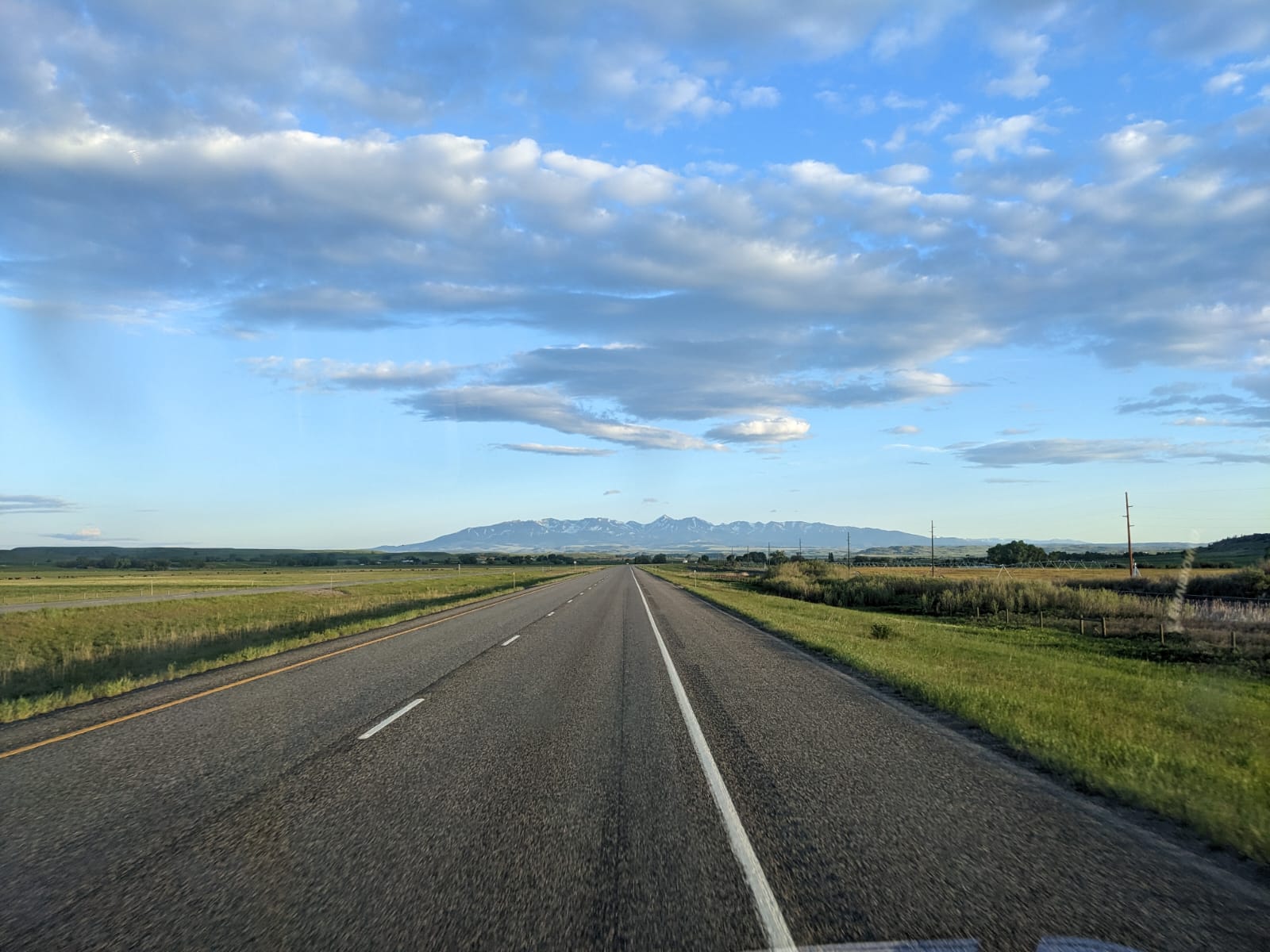
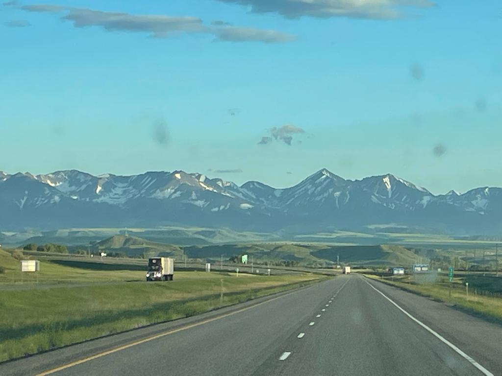
The view alongside
In any event, you can see why they call Montana “Big Sky Country”….
The Crazy Mountains are getting closer….
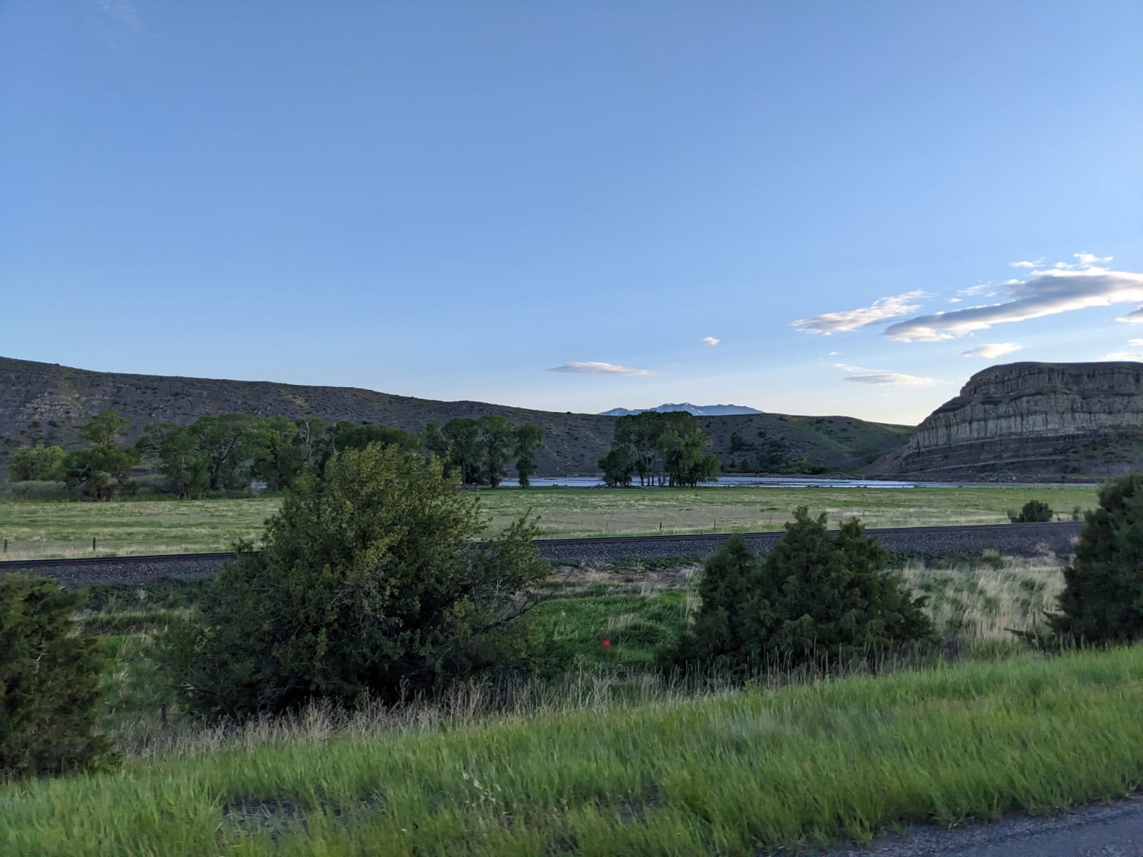
And the Two-Thirds Trimorons are drawing towards Port Townsend….
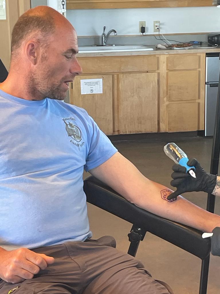
In Washington State, they have mussel-sniffing dogs! “Finn was certified as a Zebra/Quagga mussel-detection dog in 2022”!
It looks like they’ll be following Route 90 into Seattle, and taking the ferry from there!
Despite spending 30 years crisscrossing the United States as a long-haul trucker, Vlad doesn’t recall having been on route 94. So 2/3 of the Trimorons decided to take the Northern Route to Port Townsend. They didn’t take the Enchanted Highway, but came close enough to have a look at one of its most famous sculptures, “Geese in Flight”.
It turns out that when you’re hauling a collapsible trimaran, you end up with more than just reduced mileage and a fair amount of wind drag. You get bugs. Lots of bugs. Whose short lives, sadly, become still shorter upon contact with the amas…
Bug cemetery
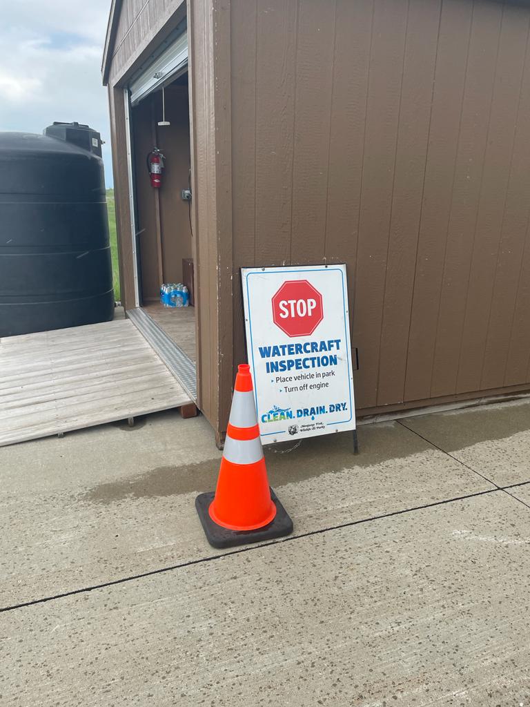
As our intrepid heroes drove into Montana, they encountered something they hadn’t expected…
All watercraft must be inspected!
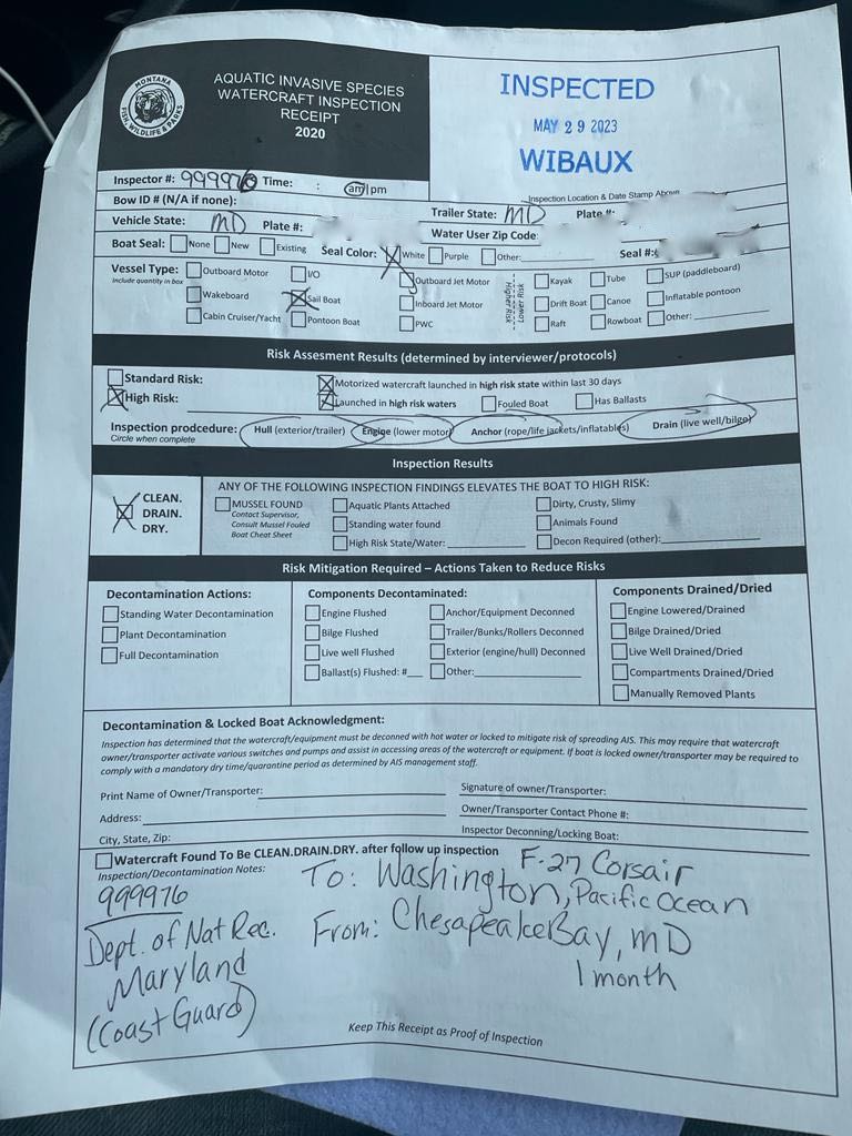
It turns out that Montana, land of 3,227 lakes, is fiercely protective of its waters. Any boats entering the state must be inspected for the presence of invasive species, which includes mussels, plants, and ummmmm… barnacles!
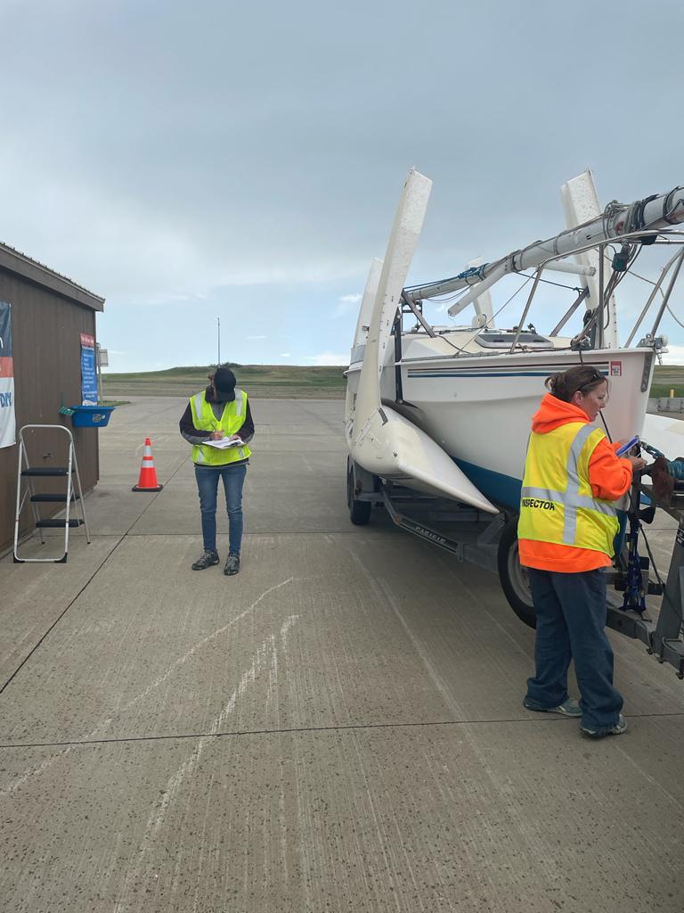
Montana boat inspection
Apparently, the boat was launched in “high risk” waters. Fortunately for all involved, it had been thoroughly cleaned, dried, and painted since it last touched water. I feel a lot better about having spent a Saturday morning last month scrubbing barnacles off the bottom!
Johna scraping barnacles in April
Of course, Vlad also thoroughly cleaned, scrubbed, and painted the boat afterward! In any event, our hard work did the trick, and the Trimorons were rewarded with this:
Cleared to proceed!
Onward!
Trimorons inform me they’re planning to stop for the night and rest up before tackling the mountains tomorrow.
Nothing much has changed here at Pomestye in a day and a half. The sky’s still cool and overcast, with drizzly-to-rainy patches. The earth smells fresh and the strawberries taste sweet. The birds chirp and the rooster crows.
But in the just under a day-and-a-half since Team Trimorons left, they’ve made it to the Dakota Badlands.
This sounds a lot more exciting than it is, as evidenced by Jeff’s video:
Sailing through the Badlands…
Fortunately, the trip thus far has been uneventful. The next big event (after arriving in Port Townsend) will be Chris’s arrival from the UK. Once the Trimorons are together… watch out, world!
The faraway sound of the “Star Spangled Banner” filters through the air. Somewhere (the base across the river?) someone plays the recording every morning at 0800.
It’s cool, about 60 degrees, and overcast, with drizzle. Earlier in the morning Vlad walked me through the garden, showing me which plants need to get fed, staked, or benignly ignored. I picked my first harvest of strawberries and pineberries (which taste like the Platonic ideal of strawberries, despite being white). The running of Pomestye is now in my hands, ready or not.
Jeff and Vlad woke up early this morning, around five. They ran a few last loads out to the van, did a few last minute checks (who has what in the first aid kit?) followed by a hearty breakfast out on the deck: potatoes, scrambled eggs, and sausage, with not quite enough coffee (but is there ever enough coffee?).
Inspecting the Rig
Then it was time to leave.
We locked Callie inside to keep her from chasing after the van and trailer. They did the requisite checking of the hitch and confirmed the lights worked, taking about 20 minutes.
I told Vlad to keep the windows open but wouldn’t say why.
Vlad Ready to Go
As Vlad stepped on the gas, I hit “play” on my phone and blasted the USSR National Anthem. The Race to Alaska traditionally starts with that, for unknown reasons (This year, they’ll be playing the Ukrainian national anthem, which seems fitting.)
They both grinned and laughed. Then with a wave and a smile, they disappeared.
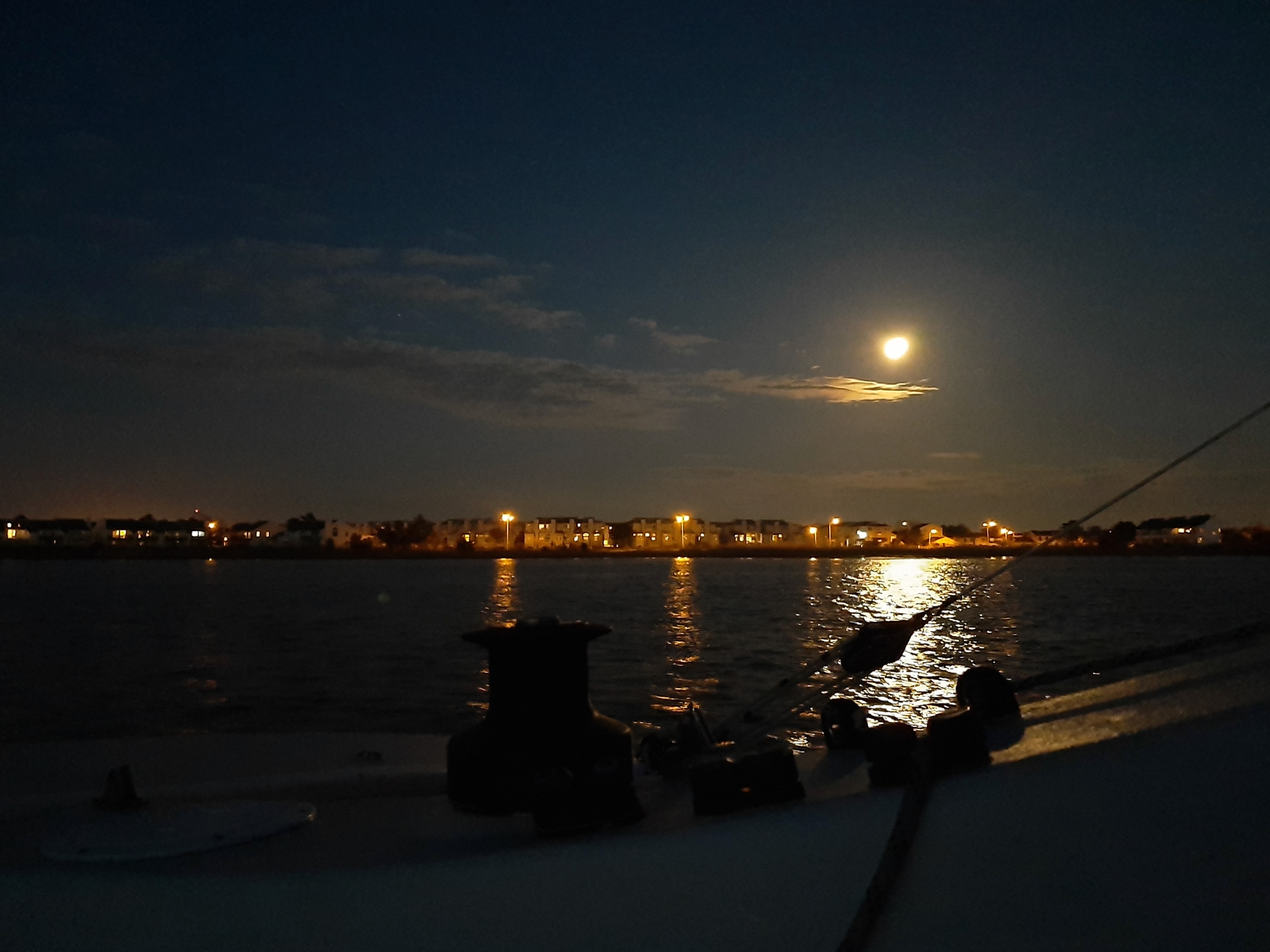
It’s not too cold. I’m not wearing my wool cap, and my nose and hands are warm. I’m in the stern cabin. Through the thick plexiglass port I can see a blurry moon.
We’re starting our second night in Great Kills Harbor in Staten Island. We arrived midafternoon yesterday. To Vov’s delight, we were able to anchor in the same spot he’d kept Nemo. The mooring field is empty-ish; there were a few boats moored, but most haven’t come out of their winter quarters yet. We could see a few people in the spit of land surrounding the mooring field, but they were distant and far off.
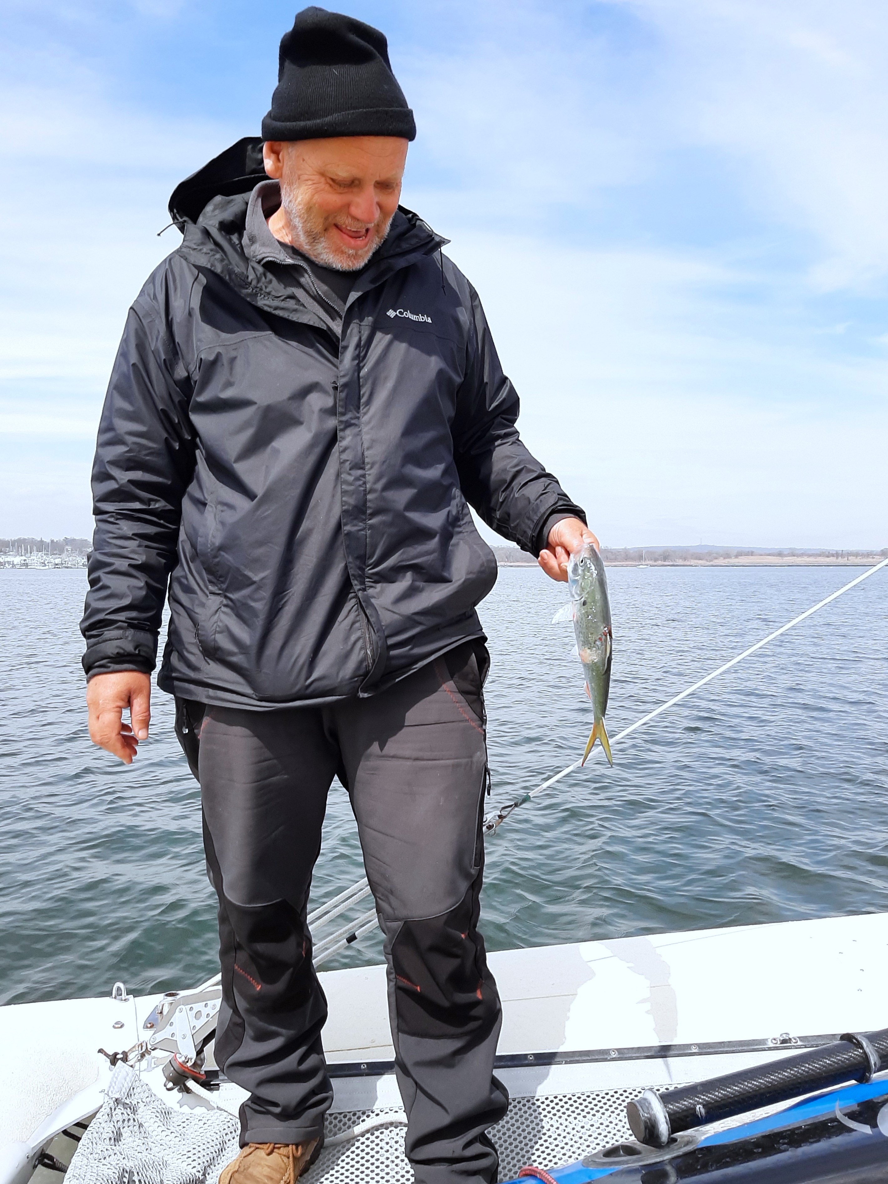
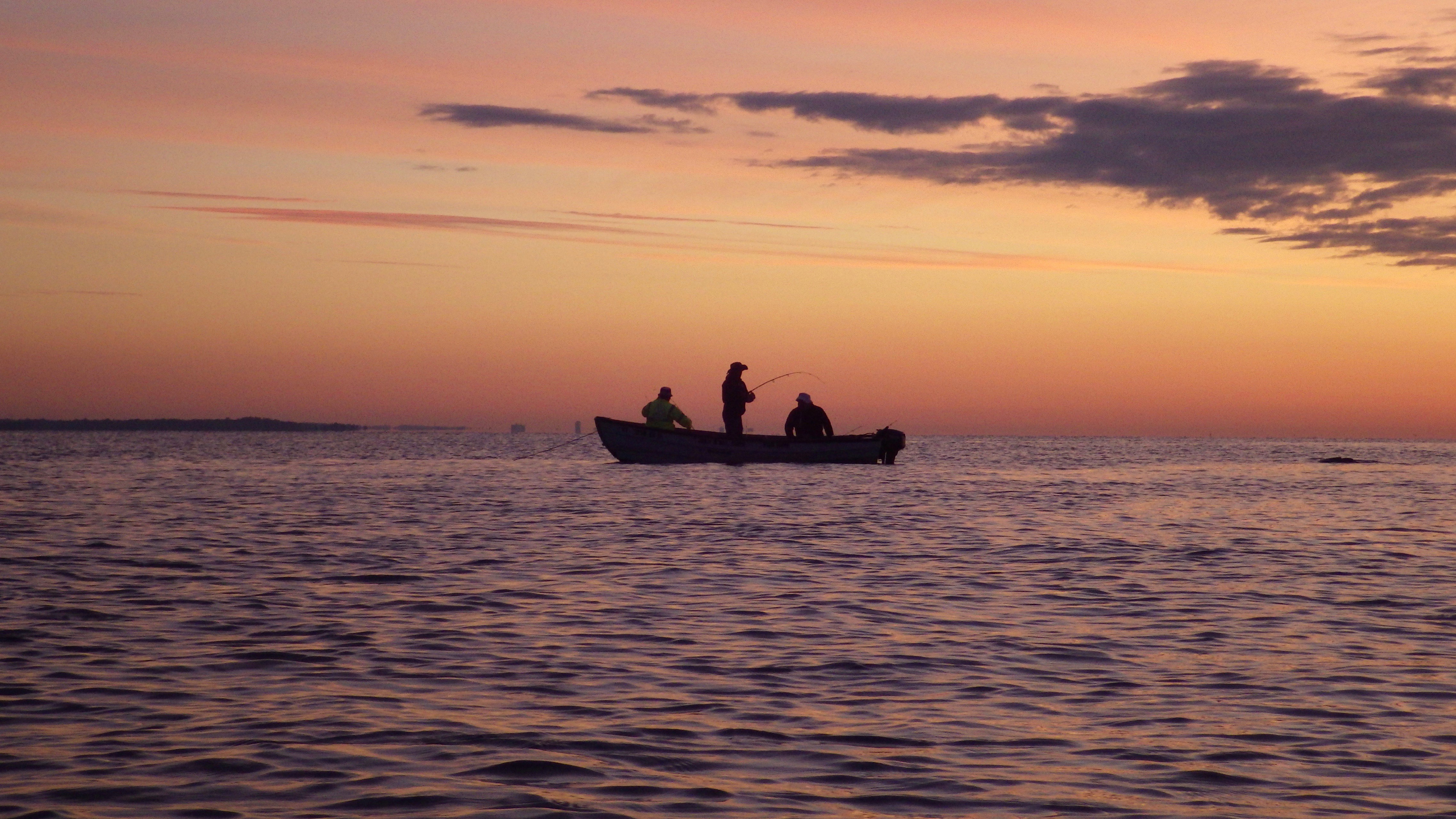
We used the time to catch our breath, and do some basic housekeeping. Vov fished, and caught five shad. We boiled them and ate them with mayonnaise. They were delicious, despite the mouthful of bones.
Fishing in Staten Island
It was surreal watching Vlad fish within the borders of New York City. Technically we didn’t need to, of course. We had plenty of food.
But it was a sort of test-drive for times to come… as was our laundry routine. Today was sunny, and we hadn’t had the opportunity to wash clothes for a week before we launched. So we washed laundry on the wings of the boat, and hung the clothes up to dry. To wash, we used buckets filled with seawater and biodegradeable soap, with our limited freshwater reserved for the final rinse.
Vov also repaired the rudder on my kayak; he’d brought his tools and fiberglass repair kit along with. Not something I would have thought of!
Meanwhile, I curled in my tiny cabin and worked. The aft cabin isn’t large enough to stand up in, although I can sit up straight (with crossed legs) in the middle, on the cushion that covers the entire floor. Most of the time I brace myself with my back against one wall and my feet against the far wall, balancing the laptop against my knees. It’s more comfortable than it sounds, and Mully often likes to crouch in the cave under my knees.
Today Mully explored the boat a bit more. He also ate (and by all appearances, greatly enjoyed) the shad. Now he’s with me in bed, alternately sitting on me, walking over me, and perched in very unlikely positions on the slanting walls.
Vov is asleep already in the main cabin.
We haven’t really talked about where we’re headed next, other than that the next sheltered anchorage is Atlantic City, a 90-to-100 mile straight shot down the coast. Vov thinks it shouldn’t be too difficult to do all in one go with the right wind, which should arrive very early tomorrow morning (between one AM and three AM). That sounds grueling, but he’s up for it; and not so long ago, during the Everglades Challenge, we were both sailing through the night as a matter of course. So he’s gone to be bed early to catch a few hours of sleep.
We both have a strong strong sense of urgency to get down south.
Staten Island to Atlantic City
Partly it’s the weather, which can be variable this time of year. Supposedly we’re getting snow again in the northeast, and high winds are on the way.
Partly is that we we won’t be into a really comfortable harbor until we’re in the Chesapeake Bay. And partly it’s the same uncanny premonition that’s driven both of us since before we met, the feeling that something bad was going to happen, and we needed to be prepared. What, exactly, that “preparedness” entailed we were still discovering. But heading south seems to be part of it.
Mully is restless. I need to let him out a bit more. But not just yet….
It’s quiet except for the sound of tires. Someone is driving on the spit of land close by. And the whir of the air vent that sounds like crickets.
The boat rocks in someone’s wake. It’s the last thing I feel before falling asleep.
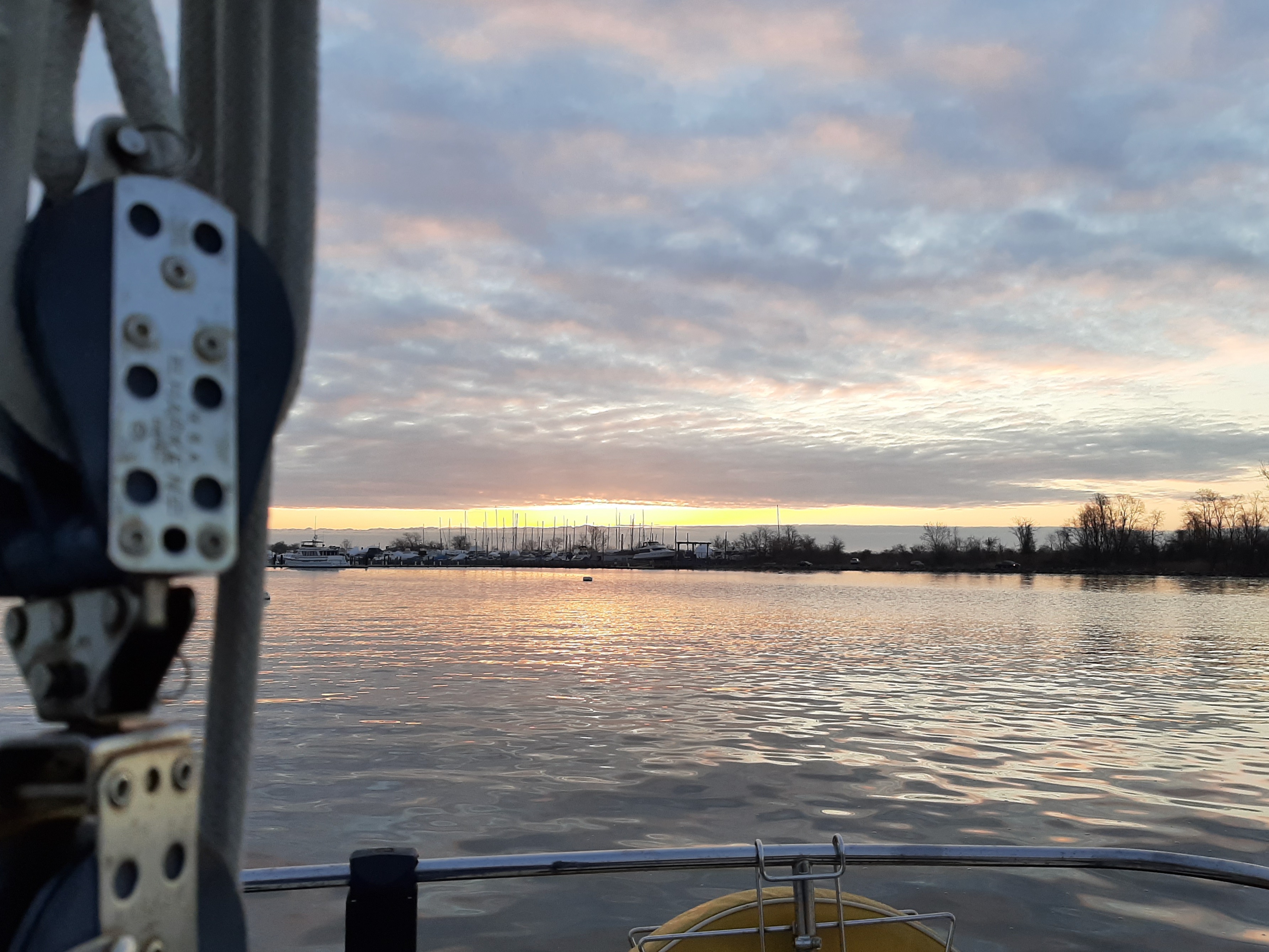
Staten Island Sunset
Tuesday April 7. 2138 HR(9:38 PM)
Sound of tiller scraping across hull, lines slapping gently against mast. Beautiful full moon rising over the water. Wind blowing in background.
Yesterday was difficult. We sailed 95 miles from Staten Island to Atlantic City. It was sunny and clear (ish) but cold, with chop. Vov woke up and and launched at 0230 HR. I couldn’t sleep much after we launched, so I got up and tried to work. That didn’t go so well. I felt seasick staring at the screen, so I abandoned the attempt and clambered into the cockpit to keep Vov company.
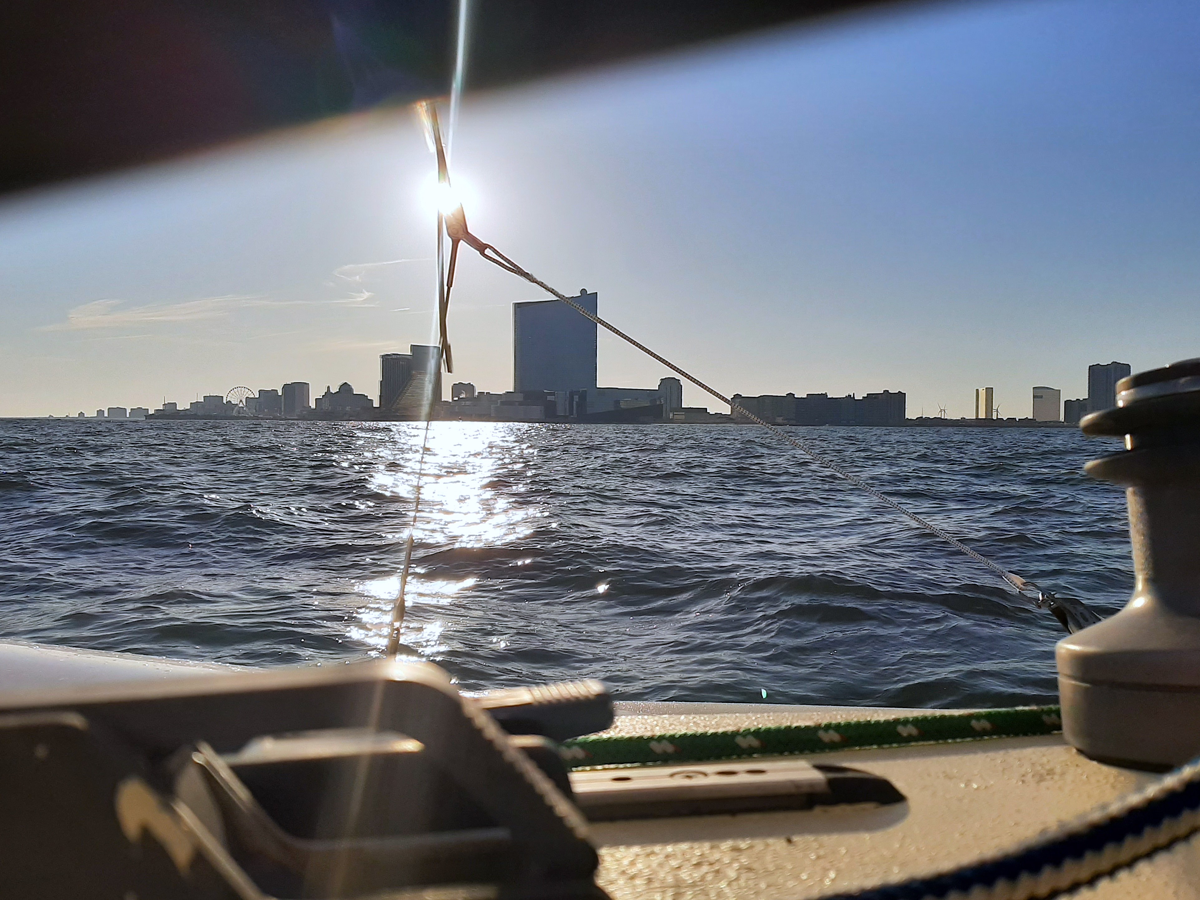
We arrived in Atlantic City around 1730 and moored. It had been an… exciting ride. We’d averaged between 6 and 7 knots due south, but gone faster over the water when you factored in the jibing. (Jibing is like tacking, except you do it downwind, not into the wind). When the trimaran heels, only two of its hulls are in the water; the other one slices through the air above the waves. And (I would later learn), jibing is the most dangerous type of sailing. So all in all, it was.. exciting.
Today we rested. I worked (depleted all the batteries!) while V napped, showered, and strategized about the trip. For dinner tonight we had sardines and “rice salad” : Garlic, onion, corn, dill, rice, and mayo. I’m calm. Not yet sleepy. I work until midnight, until my laptop runs out of juice.
Atlantic City Sunrise
Weds April 8 0900 HR (9:00 AM)
Cool, overcast, light wind. Preparing to take shower, out on the wings. There’s enough privacy where we are anchored. To shower, we will heat water on the stove, and pump it through the 1-gallon manual pressure sprayer.
This morning when I woke up, there was a feeling of sunshine in the world beyond. Even though it was gray and cold outside, it felt like the sun was rising somewhere.
I felt Mully warm and solid against my stomach, a warm weight between my ribs and hipbone. He sleeps inside the sleeping bag in the mornings. We plan to sail to Cape May today, then anchor for a few days to wait out the winds.
A strong storm front is coming; 50-knot winds are predicted. It will be my first storm at sea (on a sailboat at least.)
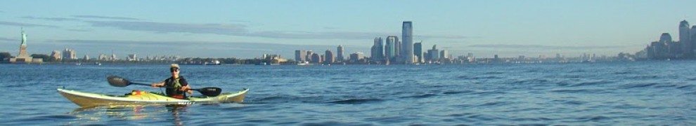
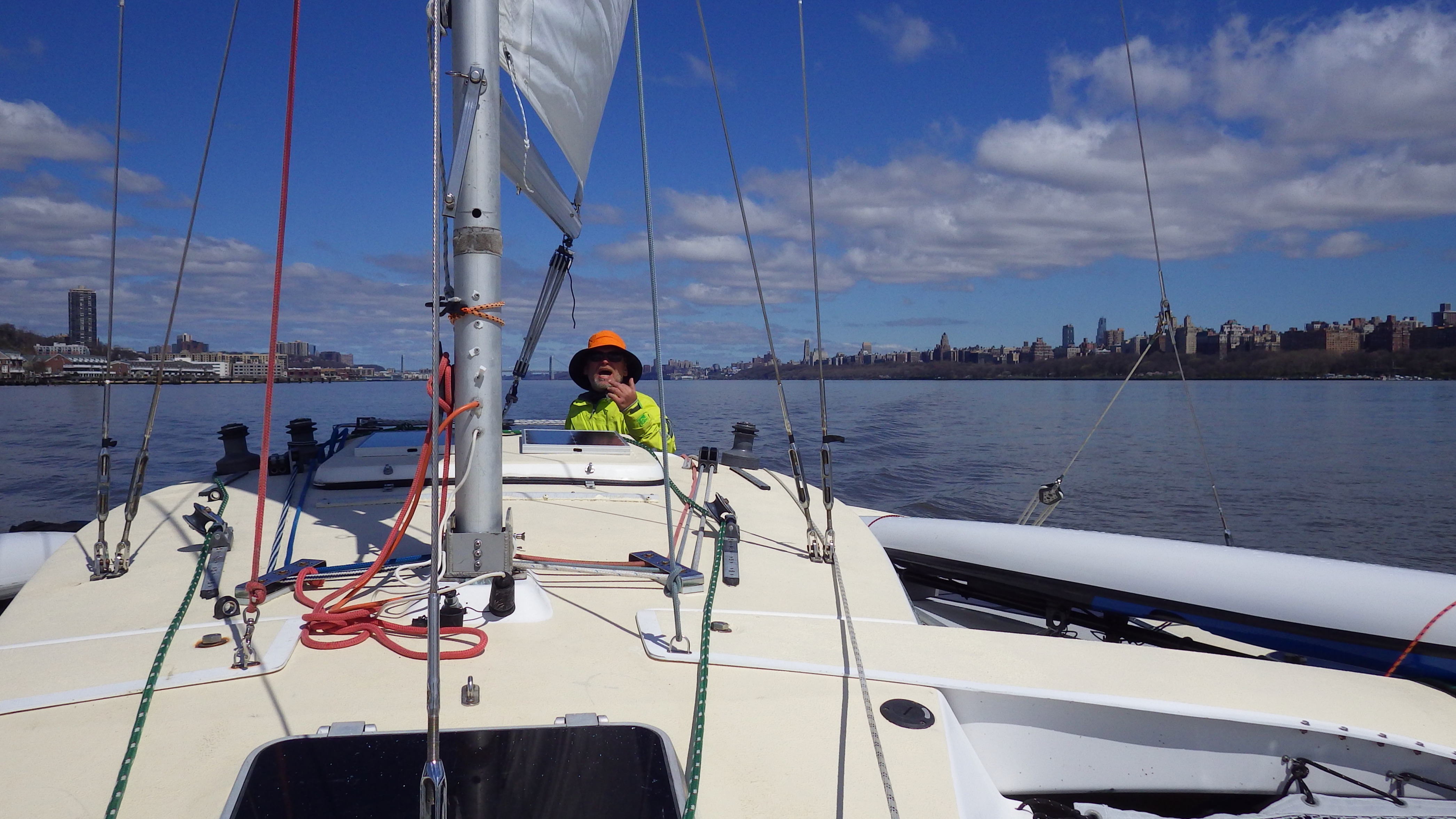
Christina Rose (lower left, with sail) passing Manhattan. Photo by A.A.
We wake early.
So far, so good. Christina Rose had handled fine during the 7-mile Hudson crossing to Croton Point. We’d travelled at a speed of 8-10 knots, with a gusty, 20-kt wind. It was bouncy, but manageable.
Mully hadn’t enjoyed the trip.
He spent the crossing in his hull tunnel, a tunnel that ran about 10 feet from the stern cabin under one of the shelves in the main cabin. We couldn’t reach him there, but we could hear him (he would occasionally emit a quiet “miaow” in response to our frantic calling). He must have been cold and terrified, but after we anchored he crawled out and snuggled in the sleeping bag with me.
Now he’s sound asleep, and complains a little in his sleep when I try to pet him. The boat is creaking, with water sloshing around me. And the wind is alternately howling and huffing. The sky is gray and lowering, the water has ominous gray and white ripples.
But the barometer on my watch says the weather will soon improve…
Vov is doing something in the main cabin, I can hear him.
Moving carefully so as not to disturb Mully, I open one of the door panels and peer out.
Ah.
Vov’s dicing onions at the tiny sink. Breakfast will be potatoes with onions, bacon, and eggs.
The plan for today is to sail down the Hudson to Staten Island. Vov had an anchorage there, in Great Kills Harbor. It was where he’d kept his sailboat, Nemo, for many years. It was about 50 miles, a straight shot down the Hudson and New York Harbor.
The route. Today’s in yellow.
Then again, there was no guarantee we’d make it that far.
Was Christina Rose even seaworthy? She’d survived several nights in the water and the 7-mile crossing, but this would be her first real test.
And was it even legal to sail in New York, given the shutdown? Would we get stopped by the police? A few days before, the Coast Guard had issued a notification saying, effectively, that it would not be imposing any controls on boating traffic due to the pandemic. But New York City was, as promised, shutting down everything–including marinas, and so far as we knew, waterways.
If we made it… then what? We hadn’t really decided. The plan was to get out of the Northeast, but we hadn’t had much time to put more thought into it. We had friends in Maryland, Virginia, and North Carolina. And there was always Florida.
But for now, the goal was to get past New York.
After breakfast, around 7:30, we set off. It was gray, raw, and overcast. We huddled in the cockpit, sipping the coffee V had made.
Manhattan ho!
It was strange sailing down the route I’d paddled so often. Under the Tappan Zee, the George Washington in the distance. Even for a spring morning, the traffic was unnervingly absent. The radio was silent, only the occasional crackle of life.
When would I paddle this route again?
As we approached the George Washington bridge, a thought occurred to me. My friend A.A. lived in Hoboken, a few blocks from the river. On impulse, I called her.
She was repairing her air conditioner, but dropped everything when she heard we were headed downriver. We wouldn’t be able to stop and visit, but at least she would see us as we passed Manhattan.
And, as it so happened, document the event (see top photo). We were almost too far apart to recognize each other, but we waved frantically and shouted.
The goodbyes, we later agreed, felt strange and solemn and scary.
We’d sailed from Croton Point to the George Washington bridge, but after the bridge we put on the motor. The goal was to get out of New York waterways as quickly as possible, before the police stopped us.
Fortunately, that didn’t happen, although it was impossible to miss us. We were the only boat on the water, which was uncharacteristically calm, with a glassy ripple. I’d never seen the river so empty, even in the dead of winter.
The familiar landmarks slipped by. Then an unfamiliar white box shape caught my eye. It was the hospital ship, the USNS “Comfort”, docked at Pier 90, just a few blocks from one of my paddling “home ports”.
Hospital ship on the Hudson
It was an eerie, science-fictional feeling to glide past a military hospital ship docked in Manhattan. We had no idea how bad the pandemic would turn out to be, but if the authorities believed we needed a hospital ship… that wasn’t good.
We continued down the Hudson, past the Battery, past Governor’s Island. True to my watch’s barometric predictions, the weather had cleared and it was a warm, slightly gusty spring day. Once we were fully in New York Harbor we cut the motor and returned to sailing. Although we hadn’t arrived in Staten Island yet, we were past the most sensitive area. If the police were going to stop us anywhere, it would have been in the Hudson near Manhattan. That they didn’t was a good omen.
One that we hoped would last for the rest of the trip!
The idea sounded crazy. Launch a sailboat from New York City, head south, and live aboard it for an unknown amount of time?
But then, the world had gone crazy.
It was March 15, 2020. Vov and I had just completed the Everglades Challenge, his 7th (or 8th, we aren’t quite sure), my second. We were driving up from Key Largo, Florida to New York, catching up on the news.
We’d been out of contact with the outside world for over a week. Things seemed to have taken a dramatic turn for the worse: Apparently New York City was on the verge of being shut down due to the pandemic.
What did that even mean, “shut down”?
Would they close the bridges and tunnels? The downside to living on an island is that during a crisis, you can be trapped. I remembered what happened on 9/11, and fought back a rising sense of claustrophobia.
Over the 20-hour drive, we obsessively scanned the news and discussed our options.
We could shelter in my apartment, the larger of the two. We’d be reasonably comfortable.
But my apartment is just a few blocks from what was shaping up to be Ground Zero for the pandemic: Mt. Sinai hospital.
If this disease were as contagious as reported, we’d have an increased chance of catching it in the narrow aisles of the grocery store, in the apartment lobby, in the elevator…
There was always Vov’s apartment in Nyack. That felt safer, and it was just a block away from the Hudson River.
But it was a one-room efficiency; no way could I manage to work there if we were both staying there.
As we ticked off the miles on I-95, the idea of sheltering at sea made more sense. Particularly if, as Vov feared, the pandemic were merely a harbinger of total societal collapse.
I didn’t think that would happen, but I couldn’t say it wouldn’t. And even if it didn’t, things could get pretty grim. I’d read John Barry’s account of the 1918 flu. At least on board a sailboat, we could leave the country if things got really bad.
More realistically, we could head south, out of the early-spring gloom. Although we didn’t know much about this virus, it’s true that ultraviolet rays are generally anti-viral and anti-microbial. And even though the phrase “social distancing” was just emerging, it’s safer to be miles away from your neighbors than breathing the same air.
Still. Living on board a sailboat? For an extended, indefinite period of time? Vov had spent over a decade living on a sailboat, so the idea made sense to him. But me? Despite the fact that I’d spent the past five days as crew on an inflatable catamaran, I didn’t even begin to know how to sail. Could I work? What about Mully, the cat that found me?
We talked through the details. Mully could live on the boat with us. We could bring the kayaks, both for recreation and as dinghies to get from the anchored boat to land. We’d get solar panels, and batteries, so I could work. We’d stay near the coastline, so we’d be within range of cellular Internet services.
As the miles ticked away, the idea of sheltering at sea began to make more and more sense.
The only question was which sailboat.
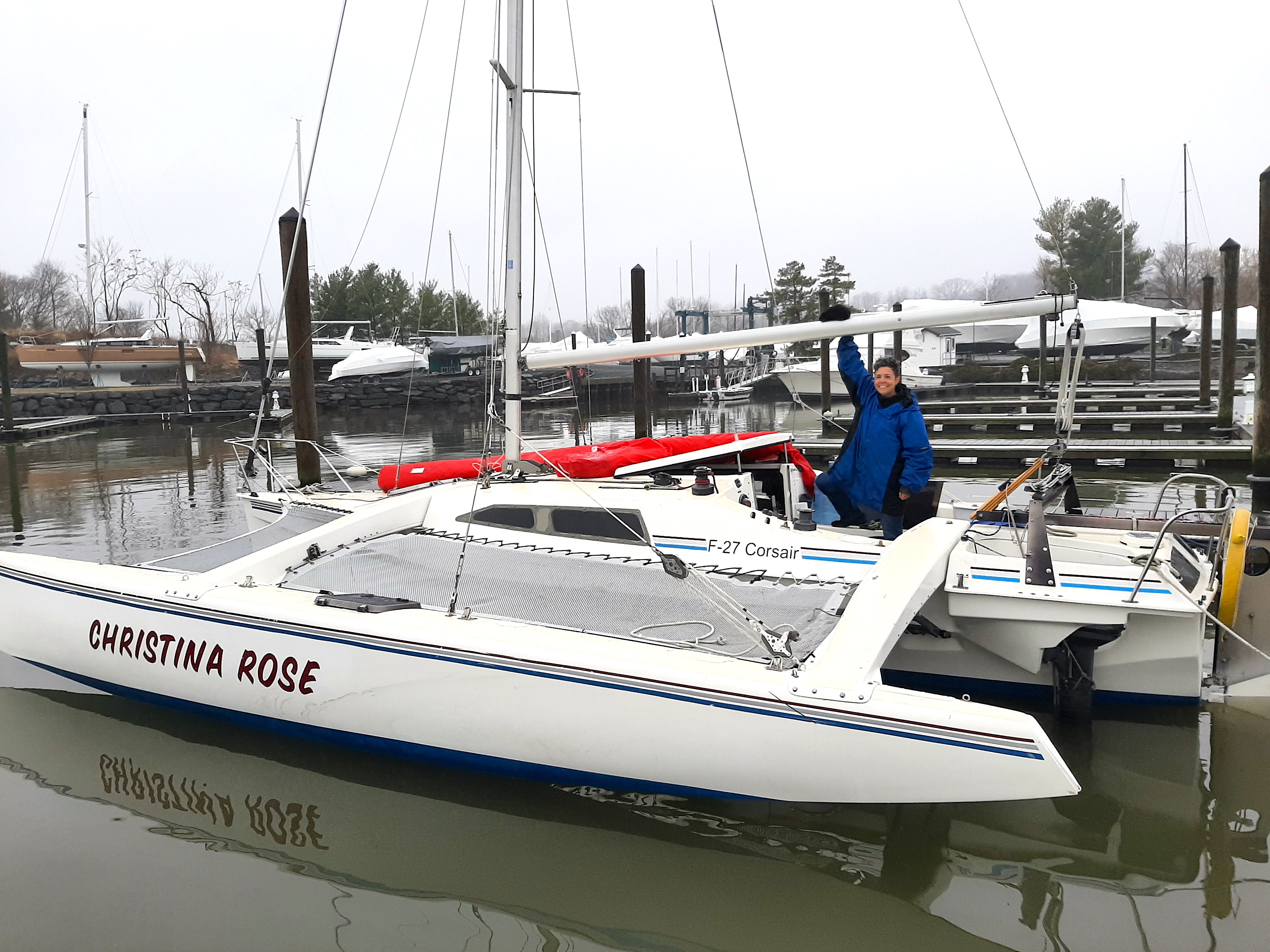
Christina Rose
Vov had a sailboat, but it was in dry dock. It needed repairs to be fully seaworthy, and with a pandemic closing everything down, getting the equipment (not to mention launching the boat) seemed risky. We could afford a used sailboat, and Vov had the model in mind: an F-27 Corsair trimaran. The wings would provide stability for me to work (trimarans don’t heel the way monohulls do), plus extra living and storage space.
But could we buy and outfit a boat fast enough?
As I drove, Vov researched. We found five boats that might work: Two in Florida (now hundreds of miles behind us, and receding rapidly). One in Ohio. And two in Massachusetts. Ohio, like Florida, seemed too far away.
Vov made inquiries about the Massachusetts boats.
We arrived in NY late Sunday morning. By Monday afternoon we’d picked Mully up from the vet where I’d boarded him. We made a hurried sweep through the apartment and grabbed what I thought we might use.
Then we headed for Nyack: Mully, gear, and all.
Less than a week later, on Saturday March 21, we were in the yard of a friendly man named Dave, in Massachusets. We met his price for the Corsair, Christina Rose. He said we could pick it up as soon as the check cleared. We drove back to Nyack and began stocking up frantically.
Three days later, Vov drove to Massachusetts, put a fast coat of bottom paint on the boat, and drove back down to Nyack.
Meanwhile, I made a final visit to the NYC apartment and picked up anything I thought we could use. Before I locked the apartment up I took a long look around. When would I see it again?
No time to wonder. Curfew would start that evening, and the rumor was that the marinas would be shut down, too. We’d pulled the two kayaks out of John F. Kennedy Marina where we kept them, just hours before the authorities closed it.
But the private marina where we were keeping Christina Rose was beginning to push back. We needed to launch, and fast.
We got her into the water on March 27. We worked frantically finish stocking it, peripherally becoming aware of the illogical grocery store shortages: Water was rationed. Toilet paper was nowhere to be had (fortunately Vov had a supply of marine toilet paper.) Hand sanitizer was gone, but rubbing alcohol was plentiful (so we stocked up.) We also bought plenty of on canned vegetables and fish, along with rice and pasta. We’d bought a supply of freeze-dried food on the way north from Florida, so we had that.
By April 1 we were ready to launch. It was a cold, gloomy afternoon. With some trepidation, we motored out of the marina. Once out on the Hudson, Vov raised the sail. We were en route!
Who is “Vov”? How did I come to be completing another Everglades Challenge, this time on a sailboat? And how did we fare sheltering at sea?
Note: I wrote the below in “before times” (before Covid).
I’m a law-abiding sort, the kind of person who pays taxes on time and in full, and who doesn’t like to cross the street against the light.
I also have a great imagination.
So when my friend R. handed me a USB stick with photos from an anonymous source apparently taken on Hart Island–where it is highly illegal to land and even more illegal to explore—I couldn’t resist imagining how an exploration might have gone down, had anyone been reckless enough to risk it. Here’s my imagined version:
“Directions to….unknown location on unknown street?” Google Maps asked.
It was fitting: I was on my way to a waterfront warehouse somewhere in Brooklyn to meet my friend R. for a clandestine expedition—so clandestine that even Google Maps couldn’t discern the starting location.
It was just after dark on a Saturday evening in late summer. The plan for the excursion had come together with surprising speed, in one of those serendipitous ways that just tells you the universe works mysteriously in your favor.
We were supposed to be doing a different expedition, a trip down the eastern coast of Staten Island. But then R. sent me a tantalizing note: “Text me on encrypted channel? I’ve got an idea for a mission I don’t want to talk about.”
We connected, and he shared his idea: We would launch from someplace in City Island, paddle to Hart Island and explore.Hart Island has a long and storied history dating back to pre-revolutionary times. It currently serves as New York’s Potters’ Field, where the bodies of those who died unclaimed lie in rest. They are buried by prisoners from Riker’s Island, who arrive each morning on the ferry, and depart at sundown. The island is uninhabited by humans—other than the approximately one-and-a-half million dead—from sundown to sunrise.
Most NYC-area kayakers harbor a secret wish to explore Hart Island, due to its mystery, its historical significance… and also because it’s tantalizingly available yet completely forbidden. For complicated historical reasons, it’s managed by the Department of Corrections. Trespassing on the island is trespassing on prison property, and carries a two-year prison sentence.
Vlad and I had landed on Hart Island many years ago and had lunch on one of the beaches, but I’d never gone further, out of fear of the authorities, and also out of respect for the dead. There’s an air of sadness over the island. Anyone who lies buried there was alone at the end of his or her life, so each grave marks not just a death but a person whose life ended in loneliness and disconnection.
And that life may have been tragically short: Among the graves on the island is that of the first baby to die in NYC of the then-new AIDS virus in the 1980s. He or she lies buried at the southern tip of the island, in a special area apart from all others. The authorities didn’t understand AIDS then, and feared contact even with the corpse of a baby.
This might be the last chance for such an expedition. R. explained that in October a massive renovation would launch, shoring up the crumbling beaches eroded by storms.
Apparently during superstorm Sandy in 2012, bodies had washed out into Long Island Sound, ending up on the beaches of well-off waterfront property owners.
There were complaints.
After several years, the city eventually decided to take action. Details are few, but as part of the renovation they will probably wall off the shoreline, wire the entire island with surveillance cameras, and generally bring it from the 19th into the 21st century. And it would all start in a few weeks.
So this was it: a now-or-never moment.
“I’m in,” I said.
Then I realized he meant we’d go at night.
Wait, what?
How would we see anything?
And… seriously, explore the largest cemetery in the country at night?
But I quickly realized R. was right. If we wanted to avoid detection, it would have to be at night. If it stayed clear, we’d have the light of the gibbous moon, and we’d have red-spectrum headlamps.
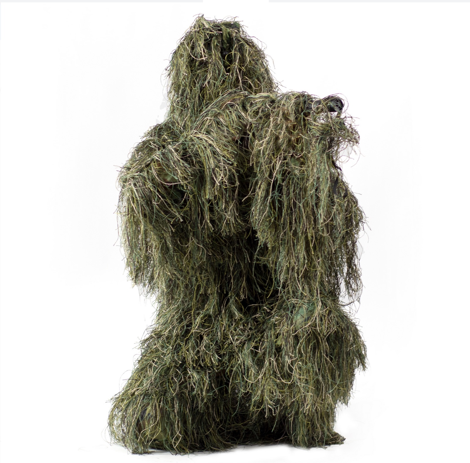
There was more: R. had been planning this trip for a while. He had two Ghillie suits, unworn and ready to go.
Ghillie suit
Snipers and hunters wear Ghillie suits to avoid detection. “You really can’t be seen, even in they shine a spotlight on you. They’re amazing!” R. said.
What he hadn’t said was that you look like Chewbacca covered in Spanish moss when wearing them. And they catch branches and leaves while you’re walking until you feel like you’re part Ent. But that comes later…
We planned to meet up in Brooklyn around 9 PM, then drive out to City Island. We’d locate an acceptable launch spot, paddle out, and explore, making sure to be gone by dawn.
So far all was going well.
Google Maps navigated me efficiently enough to “unknown location on unknown street” on the Brooklyn waterfront. Sure enough, R. was waiting. We drove off into the quiet Brooklyn night, lit by the lopsided moon in a clear dark sky.
When we got to City Island, we were confronted by an unexpected challenge. Both of us had landed by kayak at City Island at various times over the years, and R. had launched from there more than once. We both had firm recollections of streets dead-ending onto open beaches, so we hadn’t really worried about finding a launch spot.
But this time, inexplicably, there were none.
For over an hour we explored City Island street by street, only to be confronted with high fences and “Private beach: Keep out!” signs blocking the waterfront access.
After about ninety minutes we’d located a couple of places that weren’t entirely insurmountable; although clearly labeled as private property, the houses nearest the beach seemed uninhabited and it would be possible, with effort, to maneuver loaded boats around and over the barriers.
But both of us were uneasy about the idea, and we kept looking, although our hopes were fading rapidly. Suddenly, R. squinted into the darkness ahead of us. “Wait, is that a Jersey barrier?” he asked. It was. Nice and low, about two-and-a-half feet high, with one corner conveniently worn away so we wouldn’t even have to lift the boats over.
Even better: there were no “No Trespassing” signs. The buildings adjacent were dark and seemingly unoccupied. And the neighborhood had plenty of parking.
We parked and loaded up the boats. Deck bags. Cameras. Hiking shoes. Jacket in case it turned cold. Water. And the Ghillie suits.
Soon we were launched and paddling the moonlit waters of Long Island Sound.
It was a calm, warm night, and the water was clear as glass. The stars, nearly invisible from midtown, twinkled brightly over the Sound.
We kept lights and radios off, but our eyes quickly adjusted to the dim light. We could track each other’s shadowy profiles in the dark.
It was only about a mile to Hart Island, but in the calm night, hearing only the splash of our paddles and the muffled sounds of traffic from the Bronx behind us, the trip seemed to last forever.
Finally we pulled the boats up on the beach. Just as I’d remembered it from a decade before, there was the wreckage of a large motorboat at the north end of the beach.
“We can hide the boats there,” R. whispered.
The word was the deed.
Moving as quickly as we could, we slotted the boats into gaps of the wreckage, and draped tarps over them. From just a few feet away, they were virtually invisible.
Then we changed into hiking shoes, mounted our headlamps, and pulled on the Ghillie suits, which were surprisingly light considering the bulk. They were made of fine mesh, good for keeping out insects, and would provide an extra barrier against the poison ivy R. said grew copiously on the northern tip of the island. Then we climbed up the low hill to the grassy meadow. We were officially on Hart Island!
The first place we visited was a large white cross set into the hillside. We paused for a moment, letting the solemnity of the space sink in. Then we started walking again, and soon located a grave off to the side. We thought it was the AIDS baby’s, but R. checked the map and realized we were at the wrong end of the island.
We rounded the northern tip and looked out on the dark waters of Long Island Sound. Then we headed south.
Our steps sounded loud; we winced with each crunch and crackle on the dry leaves and sticks. But the Ghillie suits worked as advertised—even from a few feet away, we were invisible to each other in the gloom.
It wasn’t entirely dark. In addition to the moon and starlight, there was the electric glow of New York City low on the horizon. And when we turned on our infrared headlamps, the glow took on a rosy tinge.
But our lights weren’t on when I caught sight of something glowing, just behind my right shoulder.
“R.!” I whispered urgently. “There’s a ghost!”
“I believe it!” he said. For the rest of the evening, I felt the presence and faint glimmer of… something….someone… following behind me.
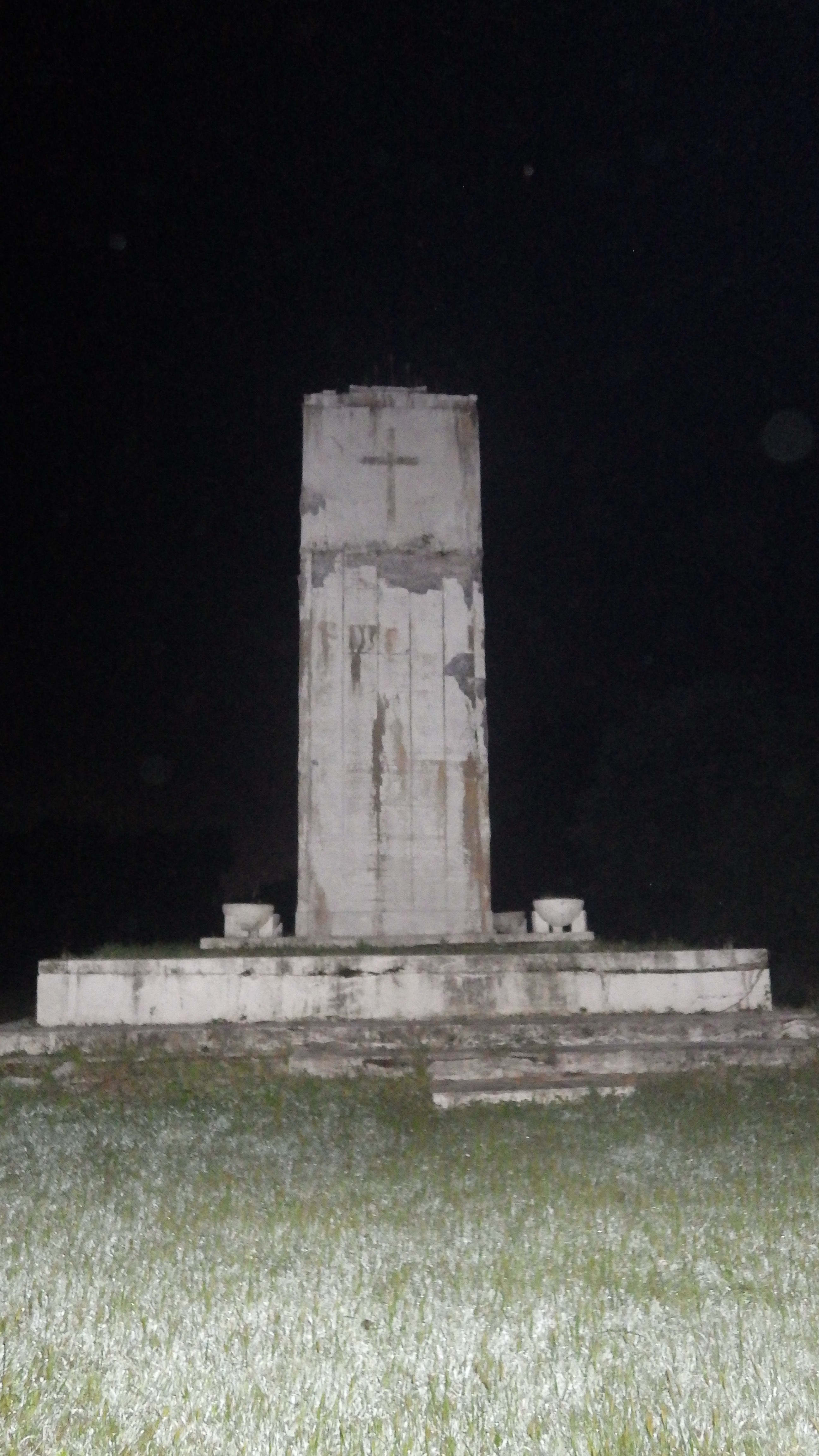
We stopped to admire a square white obelisk set on a platform, inscribed with a white cross. It was the peace monument, erected by prisoners and staff in 1948 to commemorate those interred on the island (see this account for a brief description.) We continued on. The night swirled with strange gusts of air: at one moment it was cool enough to make our skin prickle, the next warm as if from an oven opening.
“I’ve got chills,” R. whispered. “Me too,” I replied. I couldn’t stop thinking about the million-and-a half people who died alone, either unloved or unfound by frantic friends and relatives, to lie forever in the soft earth lapped by the waters of Long Island Sound.
Memorial
We kept walking. Soon we came across a clearing, dotted with flat metal plates set into the ground. It was the abandoned Nike missile silos (See: here, here, and here.)
R. was able to move one of the heavy metal covers and peer down inside. “I’m tempted to go in,” he whispered. R. is a rock climber, capable of athletic feats I can only dream of. Still, I was glad when he decided against it.
We continued on, down the eastern side of the island. As we crunched over broken branches and swished through the tall grass, we caught sight of an American flag rippling over a rectangular plot of land, lined with white marble, on which stood a white obelisk. It was the Civil War Veteran’s Cemetery The inscription on the obelisk read: “The remains of these veteran Union soldiers and sailors were disinterred on June 9, 1941 and reinterred in the Cypress Hills National Cemetery.”
We stood quietly for a moment with bowed heads. I don’t know what R. thought, but I was imagining the men who had once been buried here.
Then we continued on, doing our best to stay close to the edge of the clearing, with forest on our left.Suddenly we heard something rustle in the woods beside us.
We froze, barely breathing.
There was a loud “thump” and then what sounded like footsteps, moving rapidly away.
“What was that?” we asked each other. Intellectually we knew it had to be an animal of some sort, possibly a raccoon; R. had been told by someone who’d worked there that there was a large population of raccoons on the island.
But still.
After a bit our heart rates returned to normal, and our palms stopped sweating. Over to the right we could see ruins of old buildings silhouetted dimly against the sky.
We kept on, steering well clear of the operations hub in the center of the island, and the ferry terminal beyond that. If there were cameras or watchers, that’s where they’d be.
We continued on. And on. Through what felt like endless stretches of darkened woods, bordering grassy meadows and walkways. I knew without asking where R. was headed. He wanted to pay his respects to the grave of the AIDS baby.
Once we were safely into the southern portion of the island, we swung inland, to the right. Up ahead loomed a ruined building, windowless. We stopped to peer inside.
R. went first. “Holy shit!” I heard him whisper. On the ledge of the open window was a thick stack of documents, thicker than the palm of my hand is wide, partly destroyed by mold.
“City of Yonkers police department, 1985” we read. R. flipped through the pages quickly, stopping at one with fingerprints of the dead.
We looked through the window, into the building.
The floor was completely covered with stacks of documents. A few filing cabinets stood, drawers open, with more documents within.
What was it? Why had the documents been abandoned? There was no way to know.
The online sources we’d visited said all documents had either been destroyed by fire or removed. But here was an entire building, open to the elements, packed with decaying paper documents.
We kept going, back into the grass and brush.
R. was a few yards ahead of me when I saw him freeze. “What was that?” he whispered. “I just heard something breathe!”
Just then, some footsteps sounded. The trees rustled. Then silence.
Whatever it had been was gone.
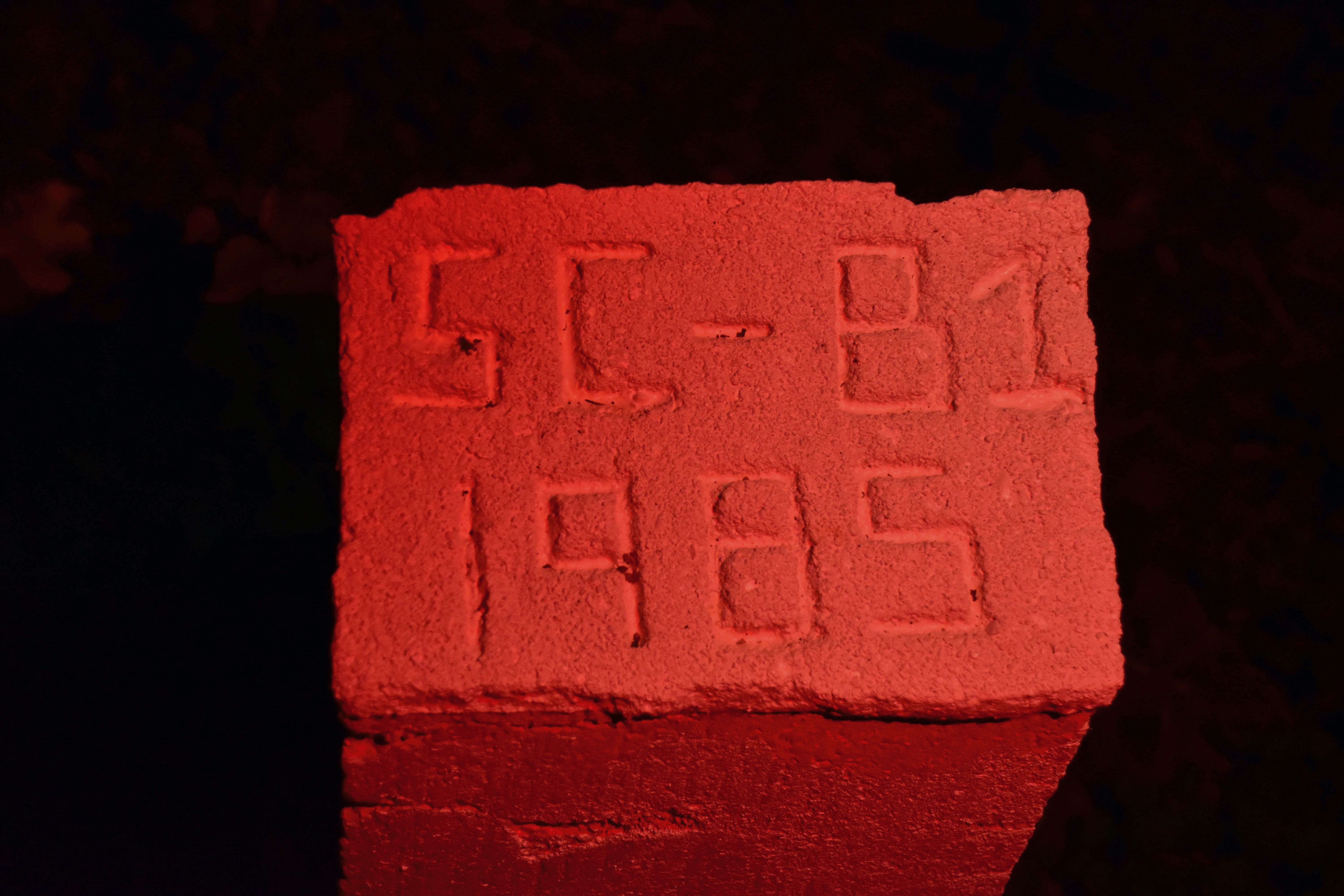
We continued on, until we were nearly at the southern tip of the island. Ahead of us stretched a row of white square posts, each marking the site of dozens, perhaps hundreds of graves.
“This is it,” R. said. Each one had the SC-B (Special Child-Baby) notation, indicating babies were buried there.
We moved along the line of graves, stopping to take a picture of the very first one. We’d found the grave of the AIDS baby.
But something was wrong. Wasn’t the AIDS baby supposed to have been buried alone?
“What’s over that fence?” R. asked suddenly. To our side was a high wire fence, half-covered in greenery, topped with rusting barbed wire. As soon as we made out what it was in the pale light, we realized what it must be.
We followed the fence to its end, and curved back around, so we were on the other side.
Sure enough, there was a square white marker all by itself, fenced off from the others. Its location alone told us what we’d found: SC-B1, the first to die of AIDS, then viewed as so contagious that he or she was isolated even in death.
Special Child (SC) Baby (B)-1
We took pictures, and I said a silent prayer for SC-B1, wherever he or she was.
And for the parents of the child, likely long gone themselves. For the frightened prisoners handling what they viewed as the carrier of a highly contagious, perfectly lethal disease. For all the people touched by this disease, those who died and the ones who lost them.
Somehow SC-B1, buried alone on Hart Island, encapsulated all of the tragedy and loss and fear of that period.
We turned to head back, feeling obscurely that no matter what else happened, our mission here was done.
“There’s one more thing I want to see,” R. said. “There’s the remnants of a road, and New York City streetlights.”
We went back across the long field where we’d heard the breaths and footsteps.
Although it was less than an hour ago, it seemed like a different era: Before baby SC-B1.
Suddenly R. froze again. “Look!” he whispered. “A deer!”
My eyes straining, I finally made out what R. was pointing at: The silhouette of a deer, at the end of the meadow, against the twinkling lights of city island.
That must have been what caused the breathing, and the footsteps, and the crashing through the underbrush. (We later learned that deer had populated the island for at least 200 years; at one point it was a privately owned game preserve. The deer could possibly have been a native inhabitant of the island; or possibly it swam over. )
Now that we’d confirmed there were large animals on the island, some of the mystery left. It almost could have been an ordinary walk on an ordinary meadow on a late-summer night.
But not for long.
After a few minutes, the road appeared in front of us. Concrete, running between two abandoned buildings. And there, just as R. had said, was a New York City streetlight. Just beyond it to the right was a beautiful building, with double stairways climbing up to an impressive doorway.
Just opposite it across the road, to the left, was a dark building looming with Gothic curves against the sky.
It was a church. R. loped over to inspect it. The door was partly ajar, and he slipped inside. A second later he poked his head out: “Come inside, it’s worth it,” he whispered.
I stepped in, walking gingerly over the uneven floor. It was indeed a church, a massive ruined structure. The roof was largely intact, and there was a beautiful, strangely undamaged rose window at the far end.
We later found out it was a Catholic church, built in 1932. (A fascinating religious history of Hart Island and other components of the prison system was written by Episcopal archivist Wayne Kempton in 2006; you can Google it to find a downloadable PDF.)
Catholic church from inside
We lingered for a while in the church, perhaps too long. Even in disuse, its soaring arches and echoing interior conveyed a sense of peaceful melancholy. But finally the skies outside the windows had lightened too much to ignore, and we regretfully took our leave.
By then, we were confident we’d seen most of what Hart Island had to offer.
We were wrong. As we continued through the compound of ruined buildings, we came up to a large square hole, about 20 feet on each side, rimmed with wood.
“It’s an open grave,” R. whispered.
We looked closer. There were pallets, and what might have been simple wooden coffins beneath. We knew that bodies were stacked 3 deep in each plot; this one looked to be about halfway full.
After a moment R. moved to continue on. “Wait,” I whispered. Following an inner compulsion, I bowed my head and said an Our Father. Then I made the sign of the cross over the open grave, wanting to show these unknown people in death the respect that had been denied them in life.
Then we turned and continued on.
The walk back seemed much faster than the walk down; in fact, we overshot our landing spot and went up to the tip of the island again. After we realized our mistake, we trotted down the hill that led to the white cross embedded in the hillside that we’d seen when we first started out. The sky was definitely lighter, and there was a tinge of rose along the eastern horizon.
Neither of us wanted to leave. We sat down and tried to pick out the branches and leaves that had accumulated in our “fur”, but it was a hopeless task. We’d done a lot more bushwhacking than the suits were designed for, and our artificial foliage was now augmented permanently with the organic kind.
After a bit, R. lay down on the grass for a micro nap, foliage and all. I sat and watched the sky brighten slowly, the stars dimming imperceptibly out.
Finally, when it was too bright to risk staying any longer, I told R. we needed to go.
A few minutes later, we were back in the boats, safely pushed off from shore. For the first time in several hours, we were no longer afraid of discovery: From here on out, we were just innocent paddlers.
I was relieved, but also sad. As the dark waters of the sound lapped our boats, part of me wanted to stay on Hart Island, with the graves and the ruins and the silence. But it was time to rejoin the world of the living.
We paddled back slowly, looking back over our shoulders often to catch the sunrise.
We passed a few fishing boats out from City Island. A sailboat floated past.
We were a few yards offshore when the rising sun broke over Hart Island, reflecting off the buildings on City Island.
We’d done it, something that very few living people can lay claim to have done: spent a night on Hart Island.
Departing at dawn
Note: If you’re inspired by this imaginary experience to try a real expedition to Hart Island… I’d recommend against it.
For one thing, construction will be underway to renovate and shore up the island.
And did I mention it’s extremely illegal? Cell phones, cameras and the press are banned from the island. Getting caught on Hart Island is considered trespassing on prison property, and carries a sentence of 2 years in prison.
Good sources for more information about Hart Island are here:
Melinda Hunt, an artist who started photographing the toppled grave markers in the early 1990s, started amassing a database that is considered more complete than official records, made through a Freedom of Information Act request. She has also published a book called Hart Island and produced a film called Hart Island: An American Cemetery; these and the database all can be found at the Hart Island Project website.
Vladimir Brezina (RIP)
... kayaked the waters around New York for more than 15 years in his red Feathercraft folding kayak. He was originally from (the former) Czechoslovakia and lived in the U.K. and California before settling down in New York. He was a neuroscientist at the Mount Sinai School of Medicine in New York City. He died in 2016.
Johna Till Johnson
... is a kayaker and technology researcher at Nemertes Research. She's an erstwhile engineer, particle physicist, and science fiction writer. She was born in California and has lived in Italy, Norway, Hawaii, and a few other places. She currently resides in New York City.